[vc_row height=”large” us_bg_image_source=”media” us_bg_image=”2933″ us_bg_repeat=”no-repeat” us_bg_overlay_color=”rgba(0,0,0,0.4)” css=”%7B%22default%22%3A%7B%22color%22%3A%22%23ffffff%22%7D%7D” el_class=”main-banner inner-banner” columns=”1″][vc_column width=”1/1″][vc_row_inner columns=”2″ css=”%7B%22default%22%3A%7B%22animation-name%22%3A%22afb%22%7D%7D”][vc_column_inner width=”1/2″][vc_column_text]
Industries
[/vc_column_text][us_separator size=”custom” height=”2.2rem” breakpoint_1_width=”1600px” breakpoint_1_height=”2rem” breakpoint_2_width=”1250px” breakpoint_2_height=”1.5rem”][vc_column_text el_class=”no-br text-52″]
GIS for Water Utilities
in New Zealand
[/vc_column_text][us_separator size=”custom” height=”2.2rem” breakpoint_1_width=”1600px” breakpoint_1_height=”2rem” breakpoint_2_width=”1250px” breakpoint_2_height=”1.5rem”][vc_column_text]ArcGIS is an extensive information system that enables modernisation of workflows with easy-to-use applications for the field and office. Strengthen your organisation with smart water solutions that will increase efficiency and provide insight for decision-makers.[/vc_column_text][us_separator][us_btn label=”Talk to an expert” style=”3″ icon=”fas|chevron-right” iconpos=”right” link=”%7B%22url%22%3A%22%2Fcontact-us%2F%22%7D”][/vc_column_inner][vc_column_inner width=”1/2″][/vc_column_inner][/vc_row_inner][/vc_column][/vc_row][vc_row height=”medium” css=”%7B%22default%22%3A%7B%22padding-top%22%3A%223rem%22%2C%22padding-bottom%22%3A%220px%22%7D%2C%22laptops%22%3A%7B%22padding-top%22%3A%222.5rem%22%2C%22padding-bottom%22%3A%220px%22%7D%2C%22tablets%22%3A%7B%22padding-top%22%3A%222rem%22%2C%22padding-bottom%22%3A%220px%22%7D%2C%22mobiles%22%3A%7B%22padding-top%22%3A%222rem%22%2C%22padding-bottom%22%3A%220px%22%7D%7D” columns=”1″][vc_column width=”1/1″][us_hwrapper valign=”middle” wrap=”1″ link=”%7B%22url%22%3A%22%22%7D” el_class=”breadcrumbs-wrapper”][us_text text=”Home” link=”%7B%22type%22%3A%22homepage%22%7D” tag=”h5″ icon=”fas|angle-right” iconpos=”right” css=”%7B%22default%22%3A%7B%22color%22%3A%22%23A0A0A0%22%2C%22margin-bottom%22%3A%220px%22%7D%7D”][us_text text=”Industries” link=”%7B%22url%22%3A%22https%3A%2F%2Feagle.nzstaging.com%2Findustries%2F%22%7D” tag=”h5″ icon=”fas|angle-right” iconpos=”right” css=”%7B%22default%22%3A%7B%22color%22%3A%22%23A0A0A0%22%2C%22margin-bottom%22%3A%220px%22%7D%7D”][us_post_title tag=”h5″ link=”%7B%22type%22%3A%22post%22%7D” css=”%7B%22default%22%3A%7B%22color%22%3A%22%23E8B130%22%2C%22margin-bottom%22%3A%220px%22%7D%7D”][/us_hwrapper][/vc_column][/vc_row][vc_row columns=”1″][vc_column width=”1/1″][vc_column_text]
Strengthen network visibility
[/vc_column_text][us_separator size=”custom” height=”3rem” breakpoint_1_width=”1600px” breakpoint_1_height=”2.5rem” breakpoint_2_width=”768px” breakpoint_2_height=”1.5rem”][vc_row_inner columns=”2-1″ columns_gap=”%7B%22default%22%3A%223rem%22%2C%22laptops%22%3A%223rem%22%2C%22tablets%22%3A%223rem%22%2C%22mobiles%22%3A%221rem%22%7D”][vc_column_inner width=”2/3″][vc_column_text]Create a connected, real-time view of assets, networks, and operational activity across electricity and gas infrastructure.[/vc_column_text][/vc_column_inner][vc_column_inner width=”1/3″][/vc_column_inner][/vc_row_inner][us_separator size=”custom” height=”3rem” breakpoint_1_width=”1600px” breakpoint_1_height=”2.5rem” breakpoint_2_width=”768px” breakpoint_2_height=”2rem”][vc_row_inner columns=”2″ columns_gap=”%7B%22default%22%3A%222rem%22%2C%22laptops%22%3A%221.5rem%22%2C%22tablets%22%3A%221.5rem%22%2C%22mobiles%22%3A%221.5rem%22%7D”][vc_column_inner link=”%7B%22url%22%3A%22%22%7D” css=”%7B%22default%22%3A%7B%22padding-left%22%3A%222.5rem%22%2C%22padding-top%22%3A%222.5rem%22%2C%22padding-bottom%22%3A%222.5rem%22%2C%22padding-right%22%3A%222.5rem%22%2C%22border-style%22%3A%22solid%22%2C%22border-left-width%22%3A%221px%22%2C%22border-top-width%22%3A%221px%22%2C%22border-bottom-width%22%3A%221px%22%2C%22border-right-width%22%3A%221px%22%2C%22border-color%22%3A%22%23000%22%7D%2C%22laptops%22%3A%7B%22padding-left%22%3A%222rem%22%2C%22padding-top%22%3A%222rem%22%2C%22padding-bottom%22%3A%222rem%22%2C%22padding-right%22%3A%222rem%22%7D%2C%22tablets%22%3A%7B%22padding-left%22%3A%222rem%22%2C%22padding-top%22%3A%222rem%22%2C%22padding-bottom%22%3A%222rem%22%2C%22padding-right%22%3A%222rem%22%7D%2C%22mobiles%22%3A%7B%22padding-left%22%3A%221.5rem%22%2C%22padding-top%22%3A%221.5rem%22%2C%22padding-bottom%22%3A%221.5rem%22%2C%22padding-right%22%3A%221.5rem%22%7D%7D” width=”1/2″][vc_column_text]
Next generation data management
Network models enable advanced data management tools that improve data quality and support analytics to detect patterns and reveal trends for data-driven decision-making.
[/vc_column_text][/vc_column_inner][vc_column_inner css=”%7B%22default%22%3A%7B%22padding-left%22%3A%222.5rem%22%2C%22padding-top%22%3A%222.5rem%22%2C%22padding-bottom%22%3A%222.5rem%22%2C%22padding-right%22%3A%222.5rem%22%2C%22border-style%22%3A%22solid%22%2C%22border-left-width%22%3A%221px%22%2C%22border-top-width%22%3A%221px%22%2C%22border-bottom-width%22%3A%221px%22%2C%22border-right-width%22%3A%221px%22%2C%22border-color%22%3A%22%23000%22%7D%2C%22laptops%22%3A%7B%22padding-left%22%3A%222rem%22%2C%22padding-top%22%3A%222rem%22%2C%22padding-bottom%22%3A%222rem%22%2C%22padding-right%22%3A%222rem%22%7D%2C%22tablets%22%3A%7B%22padding-left%22%3A%222rem%22%2C%22padding-top%22%3A%222rem%22%2C%22padding-bottom%22%3A%222rem%22%2C%22padding-right%22%3A%222rem%22%7D%2C%22mobiles%22%3A%7B%22padding-left%22%3A%221.5rem%22%2C%22padding-top%22%3A%221.5rem%22%2C%22padding-bottom%22%3A%221.5rem%22%2C%22padding-right%22%3A%221.5rem%22%7D%7D” width=”1/2″][vc_column_text]
Real-time communication and collaboration
Improve efficiency and provide information when it’s needed the most. Maps and apps connect staff, enabling coordination and data sharing across your organisation.
[/vc_column_text][/vc_column_inner][/vc_row_inner][us_separator size=”custom” height=”2rem” breakpoint_1_width=”1601px” breakpoint_1_height=”1.5rem” breakpoint_2_width=”768px” breakpoint_2_height=”1.5rem”][vc_row_inner columns=”2″ columns_gap=”%7B%22default%22%3A%222rem%22%2C%22laptops%22%3A%221.5rem%22%2C%22tablets%22%3A%221.5rem%22%2C%22mobiles%22%3A%221.5rem%22%7D”][vc_column_inner link=”%7B%22url%22%3A%22%22%7D” css=”%7B%22default%22%3A%7B%22padding-left%22%3A%222.5rem%22%2C%22padding-top%22%3A%222.5rem%22%2C%22padding-bottom%22%3A%222.5rem%22%2C%22padding-right%22%3A%222.5rem%22%2C%22border-style%22%3A%22solid%22%2C%22border-left-width%22%3A%221px%22%2C%22border-top-width%22%3A%221px%22%2C%22border-bottom-width%22%3A%221px%22%2C%22border-right-width%22%3A%221px%22%2C%22border-color%22%3A%22%23000%22%7D%2C%22laptops%22%3A%7B%22padding-left%22%3A%222rem%22%2C%22padding-top%22%3A%222rem%22%2C%22padding-bottom%22%3A%222rem%22%2C%22padding-right%22%3A%222rem%22%7D%2C%22tablets%22%3A%7B%22padding-left%22%3A%222rem%22%2C%22padding-top%22%3A%222rem%22%2C%22padding-bottom%22%3A%222rem%22%2C%22padding-right%22%3A%222rem%22%7D%2C%22mobiles%22%3A%7B%22padding-left%22%3A%221.5rem%22%2C%22padding-top%22%3A%221.5rem%22%2C%22padding-bottom%22%3A%221.5rem%22%2C%22padding-right%22%3A%221.5rem%22%7D%7D” width=”1/2″][vc_column_text]
Enable digital twin technology
ArcGIS interconnects information, systems, models, and behaviors with spatial context, creating holistic digital representations of environments, assets, networks, and cities.
[/vc_column_text][/vc_column_inner][vc_column_inner link=”%7B%22url%22%3A%22%22%7D” css=”%7B%22default%22%3A%7B%22padding-left%22%3A%222.5rem%22%2C%22padding-top%22%3A%222.5rem%22%2C%22padding-bottom%22%3A%222.5rem%22%2C%22padding-right%22%3A%222.5rem%22%2C%22border-style%22%3A%22solid%22%2C%22border-left-width%22%3A%221px%22%2C%22border-top-width%22%3A%221px%22%2C%22border-bottom-width%22%3A%221px%22%2C%22border-right-width%22%3A%221px%22%2C%22border-color%22%3A%22%23000%22%7D%2C%22laptops%22%3A%7B%22padding-left%22%3A%222rem%22%2C%22padding-top%22%3A%222rem%22%2C%22padding-bottom%22%3A%222rem%22%2C%22padding-right%22%3A%222rem%22%7D%2C%22tablets%22%3A%7B%22padding-left%22%3A%222rem%22%2C%22padding-top%22%3A%222rem%22%2C%22padding-bottom%22%3A%222rem%22%2C%22padding-right%22%3A%222rem%22%7D%2C%22mobiles%22%3A%7B%22padding-left%22%3A%221.5rem%22%2C%22padding-top%22%3A%221.5rem%22%2C%22padding-bottom%22%3A%221.5rem%22%2C%22padding-right%22%3A%221.5rem%22%7D%7D” width=”1/2″][vc_column_text]
Data-driven decision making
Devour underutilised data with world-class analytics. ArcGIS delivers capabilities such as spatial analysis, machine learning, big data analytics, and image processing.
[/vc_column_text][/vc_column_inner][/vc_row_inner][/vc_column][/vc_row][vc_row us_bg_overlay_color=”#f1f1f1″ columns=”1″][vc_column width=”1/1″][vc_column_text]
Explore what’s possible with GIS
[/vc_column_text][us_separator size=”custom” height=”3rem” breakpoint_1_width=”1600px” breakpoint_1_height=”2.5rem” breakpoint_2_width=”768px” breakpoint_2_height=”1.5rem”][vc_row_inner columns=”2″ columns_gap=”%7B%22default%22%3A%223rem%22%2C%22laptops%22%3A%223rem%22%2C%22tablets%22%3A%223rem%22%2C%22mobiles%22%3A%221rem%22%7D”][vc_column_inner width=”1/2″][vc_column_text el_class=”no-br”]GIS supports every stage of water utility operations, from network data management and field mobility to Utility Network tracing, digital twins, and 3D infrastructure analysis.[/vc_column_text][/vc_column_inner][vc_column_inner width=”1/2″][/vc_column_inner][/vc_row_inner][us_separator][vc_row_inner columns=”3″ columns_gap=”%7B%22default%22%3A%222.5rem%22%2C%22laptops%22%3A%222rem%22%2C%22tablets%22%3A%222rem%22%2C%22mobiles%22%3A%222rem%22%7D” el_class=”align-top-bottom”][vc_column_inner width=”1/3″][us_image image=”4022″ size=”full”][us_separator size=”custom” height=”2.2rem” breakpoint_1_width=”1601px” breakpoint_1_height=”1.5rem” breakpoint_2_width=”768px” breakpoint_2_height=”1.2rem”][vc_column_text]
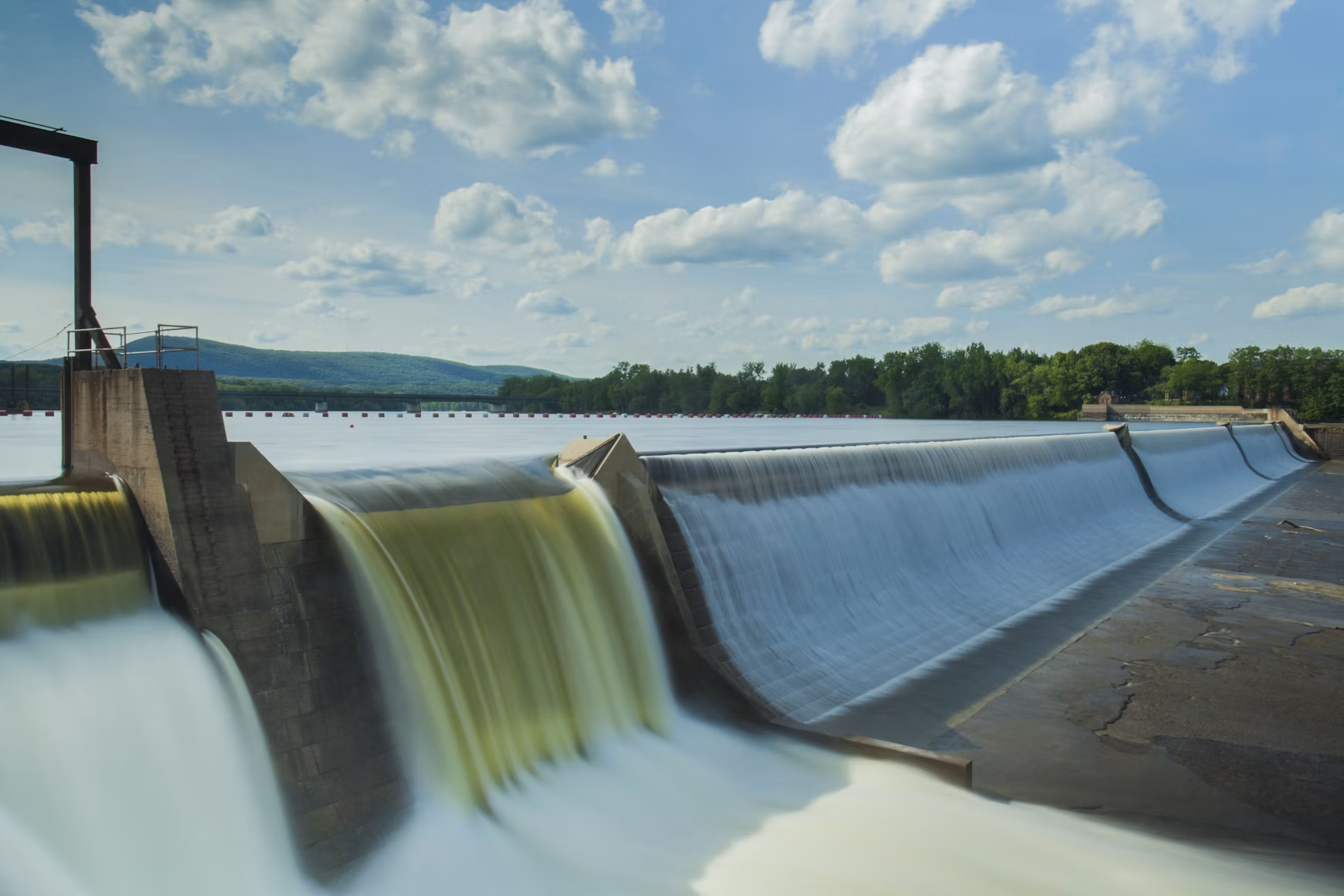
Water
[/vc_column_text][us_separator size=”custom” height=”2.2rem” breakpoint_1_width=”1601px” breakpoint_1_height=”1.5rem” breakpoint_2_width=”768px” breakpoint_2_height=”1.2rem”][vc_column_text]
Improving efficiency and reliability
[/vc_column_text][us_separator size=”custom” height=”2.2rem” breakpoint_1_width=”1601px” breakpoint_1_height=”1.5rem” breakpoint_2_width=”768px” breakpoint_2_height=”1.2rem”][vc_column_text]Utilities need to manage assets, analyse data, and make data-driven decisions. ArcGIS empowers utilities to do this with a modern data model, out-of-the-box analytics tools, and easy-to-use maps and applications. It supports digital twins, provides data in real time, and makes sharing data across the enterprise easy. ArcGIS consumes external data, includes artificial intelligence and machine learning tools, and can increase effectiveness in every corner of the utility.[/vc_column_text][us_separator][us_btn label=”Explore water distribution solutions” link=”%7B%22url%22%3A%22https%3A%2F%2Fwww.arcgis.com%2Fapps%2Fsolutions%2Findex.html%3Fgallery%3Dtrue%26industry%3DUtilities%26searchTerm%3DWater%2520Distribution%26solution%3Dl8eazp4bp63qbsk5gbcymfw31vkxjm2r%26sortField%3Drelevance%26sortOrder%3Ddesc%23home%22%2C%22target%22%3A%22_blank%22%7D” style=”5″ align=”left”][/vc_column_inner][vc_column_inner width=”1/3″][us_image image=”4026″][us_separator size=”custom” height=”2.2rem” breakpoint_1_width=”1601px” breakpoint_1_height=”1.5rem” breakpoint_2_width=”768px” breakpoint_2_height=”1.2rem”][vc_column_text]
Wastewater
[/vc_column_text][us_separator size=”custom” height=”2.2rem” breakpoint_1_width=”1601px” breakpoint_1_height=”1.5rem” breakpoint_2_width=”768px” breakpoint_2_height=”1.2rem”][vc_column_text]
Promoting efficiency and innovation
[/vc_column_text][us_separator size=”custom” height=”2.2rem” breakpoint_1_width=”1601px” breakpoint_1_height=”1.5rem” breakpoint_2_width=”768px” breakpoint_2_height=”1.2rem”][vc_column_text]ArcGIS provides sewage solutions that enable utilities to easily collect and manage infrastructure data; perform advanced analytics and visualisations; and share information across systems, improving efficiency and encouraging innovation. Understanding where your infrastructure is, what it is, and how it is networked is essential for managing and planning a sustainable future, while supporting resilience, regulatory compliance, informed decision-making, and sustainable growth.[/vc_column_text][us_separator][us_btn label=”Explore sewer solutions” link=”%7B%22url%22%3A%22https%3A%2F%2Fdoc.arcgis.com%2Fen%2Farcgis-solutions%2Findustries%2Fsewer.htm%22%2C%22target%22%3A%22_blank%22%7D” style=”5″ align=”left”][/vc_column_inner][vc_column_inner width=”1/3″][us_image image=”4021″ size=”full”][us_separator size=”custom” height=”2.2rem” breakpoint_1_width=”1601px” breakpoint_1_height=”1.5rem” breakpoint_2_width=”768px” breakpoint_2_height=”1.2rem”][vc_column_text]
Stormwater
[/vc_column_text][us_separator size=”custom” height=”2.2rem” breakpoint_1_width=”1601px” breakpoint_1_height=”1.5rem” breakpoint_2_width=”768px” breakpoint_2_height=”1.2rem”][vc_column_text]
Easier data collection, visualisation, & analysis
[/vc_column_text][us_separator size=”custom” height=”2.2rem” breakpoint_1_width=”1601px” breakpoint_1_height=”1.5rem” breakpoint_2_width=”768px” breakpoint_2_height=”1.2rem”][vc_column_text]ArcGIS enables efficient collection, management, and analysis of data and information critical to an effective stormwater program. Replace paperwork and manual data entry with easy-to-use maps and applications that will significantly reduce the time and cost associated with inspections. Visualise and analyse data to better understand where to focus resources to meet regulatory requirements and achieve sustainability goals.[/vc_column_text][us_separator][us_btn label=”Explore stormwater solutions” link=”%7B%22url%22%3A%22https%3A%2F%2Fdoc.arcgis.com%2Fen%2Farcgis-solutions%2Findustries%2Fstormwater.htm%22%2C%22target%22%3A%22_blank%22%7D” style=”5″ align=”left”][/vc_column_inner][/vc_row_inner][/vc_column][/vc_row][vc_row us_bg_overlay_color=”_content_bg” columns=”1″][vc_column width=”1/1″][vc_row_inner columns=”2″ columns_gap=”%7B%22default%22%3A%225rem%22%2C%22laptops%22%3A%223rem%22%2C%22tablets%22%3A%223rem%22%2C%22mobiles%22%3A%222rem%22%7D” el_class=”img-100″][vc_column_inner width=”1/2″][vc_column_text]
The Role of GIS in the Digital Water Transformation
Utilities’ core function is the timely, orderly movement of water flows, wastewater, and stormwater. This report, created with Bluefield Research, discusses how GIS is the foundation for digital water transformation. GIS facilitates integration, coordination, and analysis of disparate hardware and software, workers and processes, and departments and datasets across space and time.
[/vc_column_text][/vc_column_inner][vc_column_inner width=”1/2″][us_image image=”4018″ size=”full”][/vc_column_inner][/vc_row_inner][/vc_column][/vc_row][vc_row us_bg_overlay_color=”_content_overlay” columns=”2″ css=”%7B%22default%22%3A%7B%22color%22%3A%22%23ffffff%22%7D%7D” el_class=”img-100″][vc_column link=”%7B%22url%22%3A%22%22%7D” css=”%7B%22default%22%3A%7B%22animation-name%22%3A%22afb%22%7D%7D” el_class=”tech-l-padding-right” width=”1/2″][vc_column_text el_class=”text-20 no-br”]
Our approach
We combine GIS expertise, technology, and industry knowledge to help organisations make smarter decisions, strengthen operations, and create long-term business value.[/vc_column_text][us_separator size=”custom” height=”4.5rem” breakpoint_1_width=”1600px” breakpoint_1_height=”4rem” breakpoint_2_width=”1250px” breakpoint_2_height=”2rem”][vc_row_inner columns=”2″ columns_gap=”%7B%22default%22%3A%223rem%22%2C%22laptops%22%3A%223rem%22%2C%22tablets%22%3A%223rem%22%2C%22mobiles%22%3A%221.8rem%22%7D” el_class=”color-grey challenge-row”][vc_column_inner width=”1/2″][vc_column_text]
A geographic approach to problem solving
Combining spatial thinking with technical GIS expertise helps organisations better connect, manage, and understand their data to support smarter planning and operational decisions.[/vc_column_text][/vc_column_inner][vc_column_inner width=”1/2″][vc_column_text]
Training and support that builds capability
Through local training, experienced support, industry events, and knowledge sharing, we help teams build confidence, become more self-sufficient, and stay connected to the wider GIS community.[/vc_column_text][/vc_column_inner][/vc_row_inner][us_separator size=”custom” height=”2.5rem” breakpoint_1_width=”1600px” breakpoint_1_height=”2rem” breakpoint_2_width=”1250px” breakpoint_2_height=”1.8rem”][vc_row_inner columns=”2″ columns_gap=”%7B%22default%22%3A%223rem%22%2C%22laptops%22%3A%223rem%22%2C%22tablets%22%3A%223rem%22%2C%22mobiles%22%3A%221.8rem%22%7D” el_class=”color-grey challenge-row”][vc_column_inner width=”1/2″][vc_column_text]
Strategic partnerships
Eagle designs and implements GIS solutions that align to operational goals, integrate with existing systems, and deliver value as needs evolve over time. [/vc_column_text][/vc_column_inner][/vc_row_inner][/vc_column][vc_column link=”%7B%22url%22%3A%22%22%7D” css=”%7B%22default%22%3A%7B%22animation-name%22%3A%22afb%22%2C%22animation-delay%22%3A%22250ms%22%7D%7D” width=”1/2″][ultimate_spacer height=”0″ height_on_tabs=”0″ height_on_tabs_portrait=”0″ height_on_mob_landscape=”0″ height_on_mob=”20″][us_image image=”1978″ size=”full”][/vc_column][/vc_row][vc_row us_bg_overlay_color=”#000000″ columns=”2″ columns_gap=”%7B%22default%22%3A%223rem%22%2C%22laptops%22%3A%223rem%22%2C%22tablets%22%3A%223rem%22%2C%22mobiles%22%3A%222rem%22%7D” css=”%7B%22default%22%3A%7B%22color%22%3A%22%23ffffff%22%7D%7D”][vc_column width=”1/2″][vc_column_text]
Ready to strengthen water network resilience?
[/vc_column_text][us_separator size=”custom” height=”2.5rem” breakpoint_1_width=”1600px” breakpoint_1_height=”2rem” breakpoint_2_width=”1250px” breakpoint_2_height=”1.8rem”][us_btn label=”Talk to an expert” link=”%7B%22url%22%3A%22%2Fcontact-us%2F%22%7D”][/vc_column][vc_column width=”1/2″][vc_column_text el_class=”no-br”]
Talk to us about improving network operations, asset visibility, field workflows, and long-term infrastructure planning with GIS and spatial intelligence.
[/vc_column_text][/vc_column][/vc_row]