Tag: content

  • Deprecation of the Classic New Zealand Basemap Server – Effective 5 May 2025

    Deprecation of the Classic New Zealand Basemap Server – Effective 5 May 2025

    As part of Eagle Technology’s ongoing work to provide up-to-date, high-performance basemaps compatible with current ArcGIS technology, we want to inform you about an important update to our basemap services. Please review the details below to ensure a smooth transition and optimal use of these basemaps in your work.

    – Boudewijn Boogaard

    Key Points

    • Deprecation notice: Starting 5 May 2025 Eagle Technology will deprecate our “Classic Basemap Server”.
    • Redirection: URLs referencing the “Classic Basemap Server” will be automatically redirected to the “Current Basemap Server” which hosts all of the same basemaps but with a different tiling scheme.
    • Users should Identify if applications are making use of the “Classic New Zealand Basemap server”: The attributes at the bottom of the page will show “Classic Basemap Server” if this is the case.
    • Migration Advice: If you identify that you are currently using the “Classic Basemap Server” then, based upon which specific basemap you are using, consider the following:
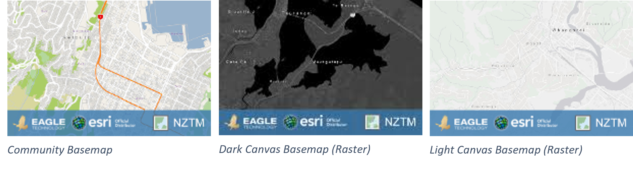
      • For users of the Community Basemap or the Dark Canvas Basemap (Raster), and the Light Canvas Basemap (Raster), see images below, these services have been in mature support since December 2022 on both the classic and current basemap server and no longer receive updates. We therefore strongly recommend transitioning to Vector Basemaps.
      • Manually migrating to the Current Basemap server or Vector Basemaps will allow proper testing and avoid potential disruptions.
    Background

    For over a decade, Eagle Technology has provided authoritative New Zealand basemaps in the NZTM projection to ArcGIS users. Over this time, significant advancements have been made, including:

    1. Introduction of Vector Basemaps; In December 2019 we introduced NZ Vector Basemaps, offering improved performance and functionality.
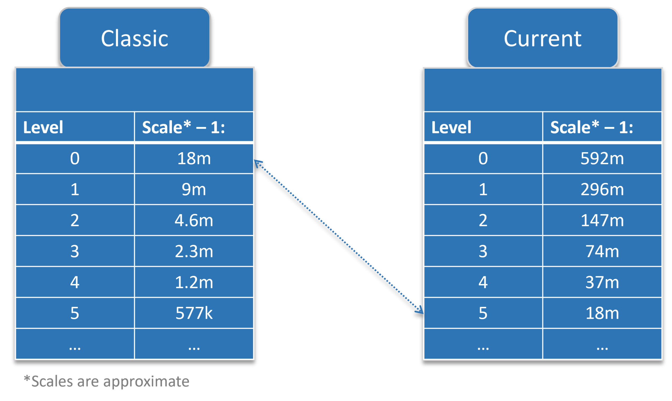
    2. Introduction of a New Basemap Server with a consistent tiling scheme; In early 2020 we deployed a new basemap server hosting the same basemaps, but with a consistent tiling scheme across all basemaps on that server for improved compatibility. The updated scheme includes:
      • 5 Additional small-scale zoom levels.
      • Larger scale zoom levels, enabling zooming to at least 1:70.
    3. Transition of Raster Basemaps to Mature Support in December 2022, as equivalent Vector Basemaps became available. This included both the Community Basemap and the Light and Dark Canvas Maps. See this blog for the announcement.

    What’s Changing?

    There are two basemap servers that host the same basemaps. The Classic Basemap Server hosts the basemap with different tiling schemes across the basemaps, the basemaps on the Current Basemap Server all have a consistent tiling scheme.

    We will redirect the URLs that currently go to the Classic Basemap Server to the Current Basemap Server.

    The basemaps on the Classic basemap server haven’t received any data updates since December 2022. The basemaps on the Current basemap server hosts basemaps that are in mature support, so they are also not receiving any updates, but the NZ Imagery and the LINZ Topographic basemaps are still being actively maintained.

    When you are using a basemap that is in mature support, we recommend migrating to one of the Vector Basemaps. Please read the blog with more information on this here.

    Scenarios That May Require Action

    While many users will experience a seamless transition, there are scenarios where adjustments may be required:

    1. Tiling Scheme Incompatibilities: Custom tiled layers aligned to the Classic Basemap tiling scheme may no longer overlay correctly. This mainly happens in 3D applications like Scene Viewer. The custom tiled layers must be re-cached using the new tiling scheme.
    2. Zoom Level Changes: Apps or URLs using specific zoom level IDs will require updates. For example, a zoom level ID of 14 on the Classic Basemap corresponds to ID 19 on the Current Basemap server.
    3. Cache and Map Updates:
      • In ArcMap: Clear the Display Cache.
      • In ArcGIS Pro: Reopen the map or project.

    Please note: These scenarios are not exhaustive, other issues may arise depending on your specific workflows or applications. We recommend thorough testing to identify and address any additional challenges.

    URLs Impacted

    The URLs that are currently directed to Classic Basemap Server and will be redirected to the Current Basemap Server are:

    • https://server.arcgisonline.co.nz/arcgis/rest/services
    • https://services.arcgisonline.co.nz/arcgis/rest/services
    • https://basemaps.cloud.eaglegis.co.nz/arcgis/rest/services

    Identify if a basemap from the Classic Basemap server is used.

    There are a few ways to identify if you are using a basemap from the Classic basemap server. You know it is coming from the Classic Basemap Server if:

    • the attributes, usually on the bottom of the map, says “Classic Basemap Server”.
    • the title of basemap layer item or the WebMap item has “Classic” in the name
    • the URL to the basemap is one of the impacted URLs

    These URLs will remain active but will be directed to the Current Basemap server.

    When migrating manually to the new server before the update, please use the services from this URL: https://services1.arcgisonline.co.nz/arcgis/rest/services

    Advised actions

    We strongly encourage users to:

    1. Identify all maps, layers, and apps that use basemaps that use the Classic Basemap server.
    2. Test and or migrate the layers to the Current Basemap server or a Vector Basemap.
    3. Update any hardcoded URLs or zoom-level parameters as needed.

    There are many ways to update the URLs depending on the situation.

    • Update the basemap in the WebMap by opening the webmap and selecting a current basemap as the new basemap for the map.
    • Update the group that holds the basemaps for the organisation’s basemap gallery. Remove the classic basemap webmaps and add webmaps with the current basemaps.

    A tool that can be helpful with updating maps and apps is the ArcGIS Assistant on https://assistant.esri-ps.com/. This tool allows you to update URLs in layers, maps and apps. Be sure to read the user guide to familiarise yourself with its capabilities.

    Basemaps in Mature support

    For users of CommunityDark Canvas or Light Canvas raster basemaps from either the Classic or the Current Basemap Server, we highly recommend transitioning to Vector Basemaps to benefit from the latest updates and support. These basemaps have been in Mature support since December 2022 which means that they have not received any data updates since then.

    HTTPS to be enforced for Eagle Basemaps

    For reasons of backwards compatibility, Eagle has allowed access to our raster basemaps using both HTTP and HTTPS. To stay in line with industry guidelines we will be enforcing HTTPS access only to our Eagle basemaps from July 2025. Any requests in HTTP will be redirected to HTTPS. In many cases the redirect will work, however there may be some specific cases where the redirect does not work, including some circumstances within custom developer applications. In these cases, the developers will need to update their applications and tools to accommodate HTTPS.


    Resources

  • NZ Raster Basemaps (Classic) Are Moving to Mature Support

    NZ Raster Basemaps (Classic) Are Moving to Mature Support

    On 5 December 2022, the remaining New Zealand “Classic” Raster Basemaps will be moving to mature support. When basemaps are moved to mature support it means that the items will still be available, but they will no longer receive updates. For this reason, we strongly recommend updating your maps, apps and basemap gallery to use the latest NZ Raster and Vector Basemaps.

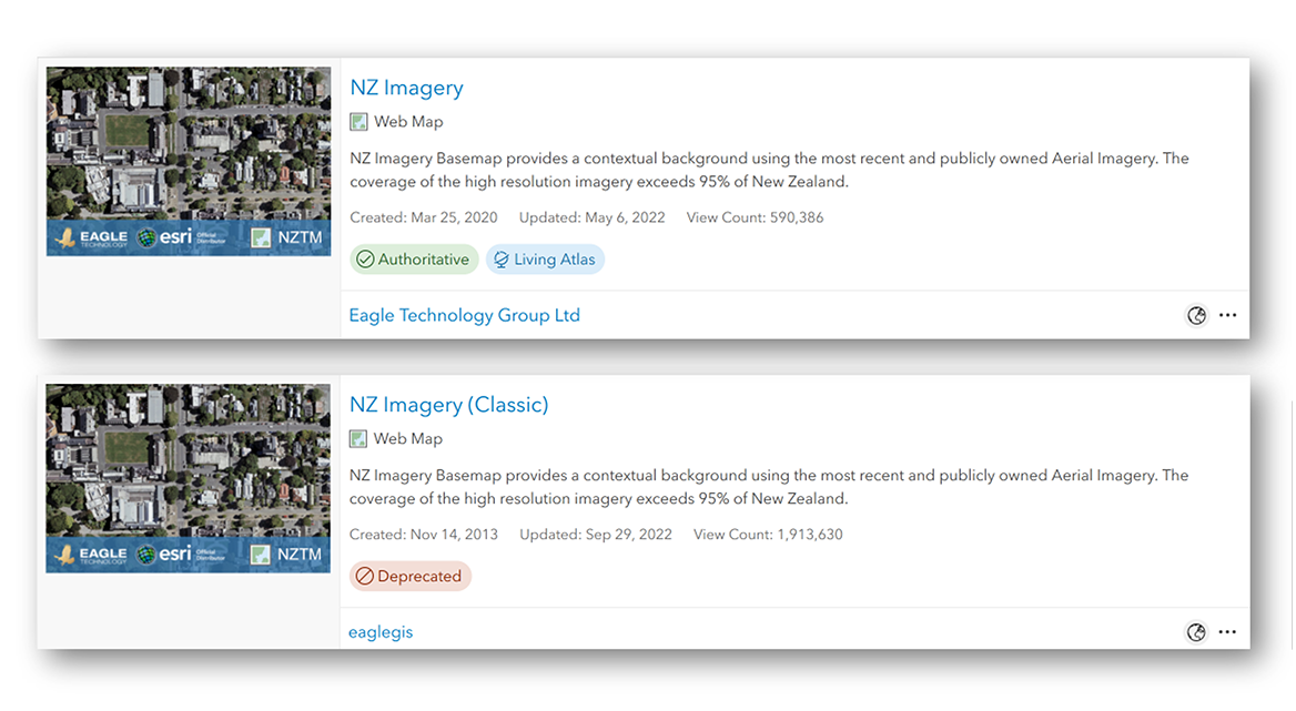
    For each NZ Raster Basemap there are two versions available:

    Why two versions of the same basemaps?

    Due to basemap switching compatibility issues with applications such as the 3D Scene Viewer, and Web App Builder we have made our basemap tiling scheme’s uniform and consistent across all NZ raster basemaps and the NZ vector basemaps. Not only will be able to easily switch between and overlay the NZ basemaps, but you can also zoom deeper as the current raster basemaps all allow zooming in to 1:70.  

    Which NZ Raster Basemaps are already in mature support?

    The following raster basemaps moved to mature support at the start of 2022:

    Both the classic and current version are not receiving any more updates. We recommend migrating to the equivalent Vector Basemap. The vector basemaps can be found in ArcGIS Online, ArcGIS Living Atlas and in this group. More information on the NZ Vector Basemaps can be found in this StoryMap.

    Which NZ Raster Basemaps will move to mature support, and which won’t?

    The following raster basemaps will move to mature support from 5 December 2022:

    The current versions of these maps will not be moving to mature support and will continue to be updated.

    If you are using one of these Classic basemaps we encourage you to migrate to the current versions of these maps, that won’t be moving to mature support:

    How can I tell which version of basemap I’m using?

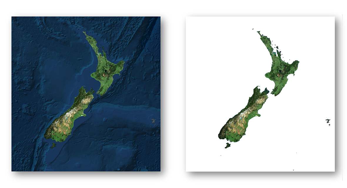
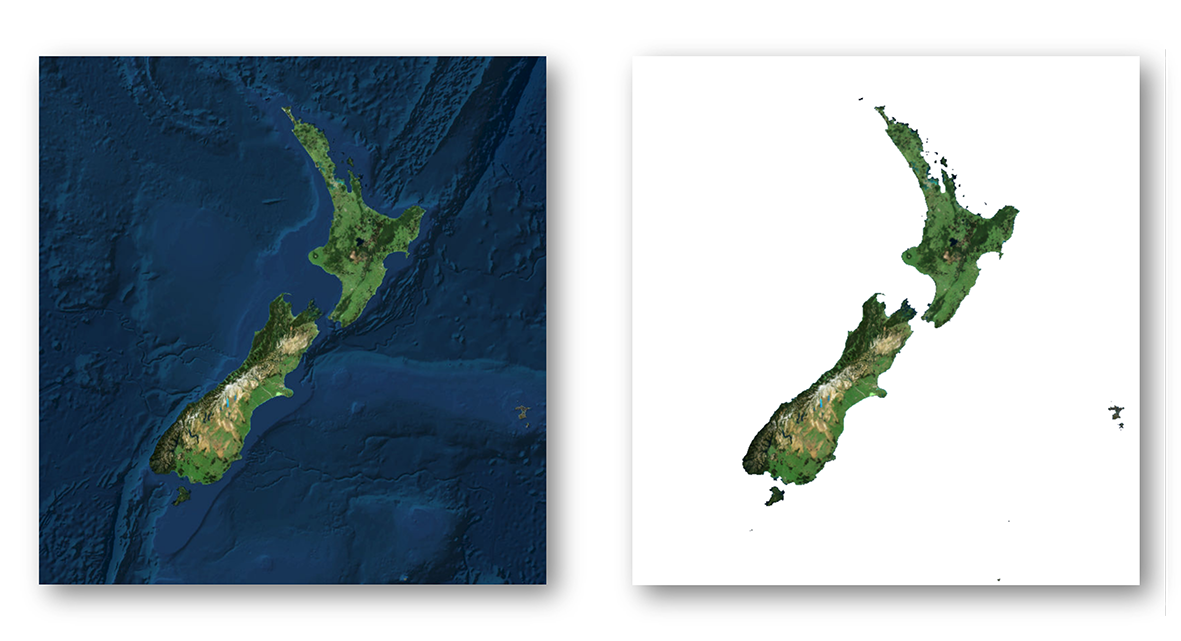
    You can easily identify which NZ Imagery Basemap you’re using by whether blue bathymetry is present. If your basemap is floating in white space, you are using the Classic version and you should migrate. Whereas, if you see blue bathymetry around New Zealand, you’re using the current version.

    For other basemaps there are a few ways you can identify if you are using the Classic version. In the web map you can open the properties of the basemap and check if it is using the services1.arcgisonline.co.nz URL.

    While in the app, you can also open the Network Tab in your Browser’s Developer Tools. If you pan the map with the Network Tab open, you can check if any requests are made to services.arcgisonline.co.nz. You can add services.arcgisonline.co.nz to the filter to more easily identify this. If there are requests made to that URL then the app uses basemap in mature support.

    Migrating

    Migrating from the Classic basemaps to the current versions or a vector basemap will in most cases be as simple as switching out the old one for the new one in the Web Map or App. There are situations where some extra care is required. In any case, testing the new basemap before switching is recommended. Here are a few cases where extra care is needed. There may be other situations where extra effort may be needed.

    Your app uses the Scale/Zoom Level ID to zoom to a specific scale or uses url-parameters to zoom to a specific scale

    With the new tiling scheme for the current raster basemaps 5 new small-scale levels have been added. This means that the scale level IDs represent a different scale. For example, scale level ID 10 in the Classic basemaps equals scale 1: 18,055.954822. In the current raster basemaps scale level id 10 equals scale 1:577,790.554289. To maintain the same scale level, you need to update the app to zoom to scale level ID 15.

    Your ArcGIS 3D Scene or ArcGIS 3D application uses other tiled layers on top of the basemap

    3D Scenes and applications are stricter when it comes to using different tiling schemes. When your 3D scene or app has a tiled layer (raster or vector) on top of one of the Classic basemaps you will most likely need to re-tile that layer using the same tiling scheme as the current NZ Basemaps. The tiling scheme can be found here.

    Update your basemap gallery

    If your organization uses a custom basemap gallery, we recommend you remove the raster basemaps that are in mature support and replace them with either the vector basemaps or the current basemaps. As this basemap gallery can be used in other locations than the Map Viewers, for example in ArcGIS Web AppBuilder applications, make sure to test if this change has any impact on your current applications, especially when your custom basemap gallery has a combination of Eagle Technology basemaps and custom basemaps that are cached using one of the Classic tiling schemes.

    When updating your basemap gallery group, make sure to add the Web Map to the group and not the layer.

    To find out how to update your basemap gallery, see this blog post:

    ArcGIS Living Atlas

    The basemaps that are in mature support or are moving to mature support are no longer available in Living Atlas. They have also received the “Deprecated” tag. This ensures they are prioritized less in search results. You can find all the Classic basemap items in this group.

    If you have any questions about this move, please get in touch with your Eagle Technolgy representatve or contact us at livingatlas@eagle.co.nz.

  • Updates to the New Zealand Imagery and Elevation layers (May 2022)

    Updates to the New Zealand Imagery and Elevation layers (May 2022)

    Since the start of the year the New Zealand Imagery, the New Zealand Elevation and the New Zealand Hillshade layers have received new data updates. This blog post gives an overview of the recently added datasets.

    New Zealand Imagery basemap

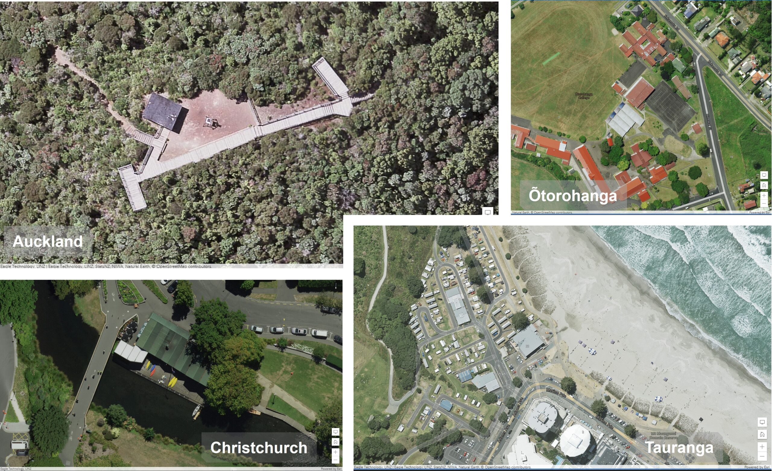
    The NZ Imagery basemap is made up of the best available public Imagery data and contains high resolution imagery for most parts of New Zealand. The following datasets have been added this year:

    • Christchurch Urban 2021 5 cm resolution
    • Tauranga Urban 2022 10 cm resolution
    • Ōtorohanga Urban 2021 10 cm resolution
    • Auckland Rural 2022 7.5 cm resolution

    Imagery screenshots

    You can find the NZ Imagery basemap in ArcGIS Living Atlas. Last year we have also released a vector basemap reference layer in NZTM that is designed to be overlaid on the NZ Imagery basemap. We also have a NZ Imagery Metadata layer available to shows what datasets are in the Imagery basemap. Currently it shows all the datasets that are used to build the basemap, because there is a lot of overlap on the imagery, we are working on an updated version of this layer to show what datasets are shown in the basemap.

    New Zealand Elevation layers

    Lots of LiDAR is being captured currently in New Zealand and a couple elevation datasets have been released this year already. These datasets are being added to both the NZ Elevation layer and the NZ Hillshade layer.

    The NZ Elevation layer is designed to be used in 3D maps and apps as a base layer to visualize the terrain. The NZ Hillshade layer is designed to be used with the NZ Topographic Relief basemap to give more context about the terrain.

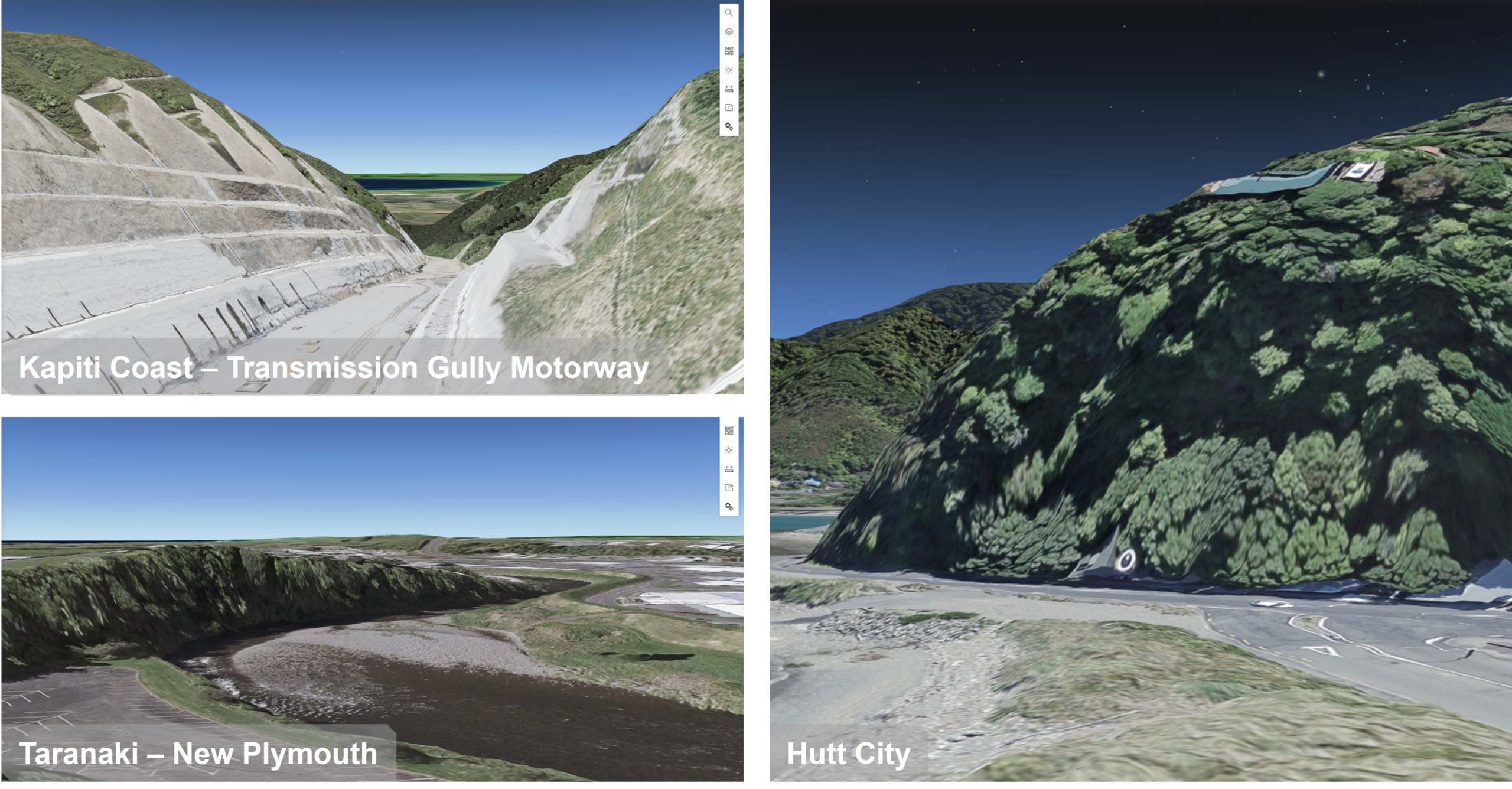
    The datasets that have been added this year so far are:

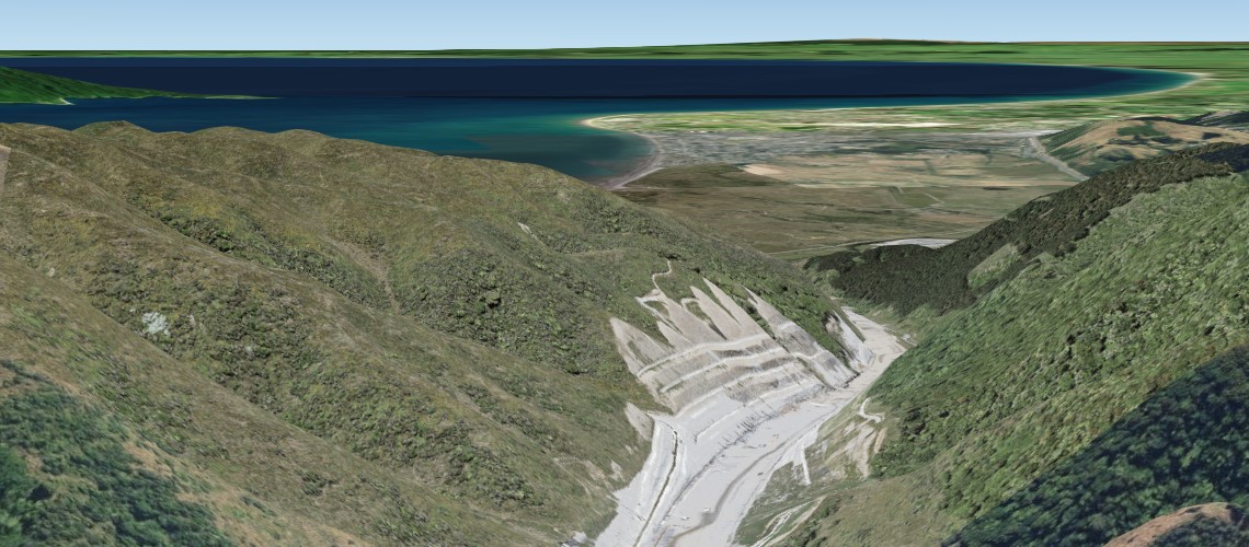
    • Kapiti Coast 2021
    • Hutt City 2021
    • Taranaki 2021

    elevation layer screenshots

    A full overview, of the more than 50 datasets that are in the NZ Elevation layer and the NZ Hillshade layer, can be viewed by using the NZ Elevation Metadata layer.

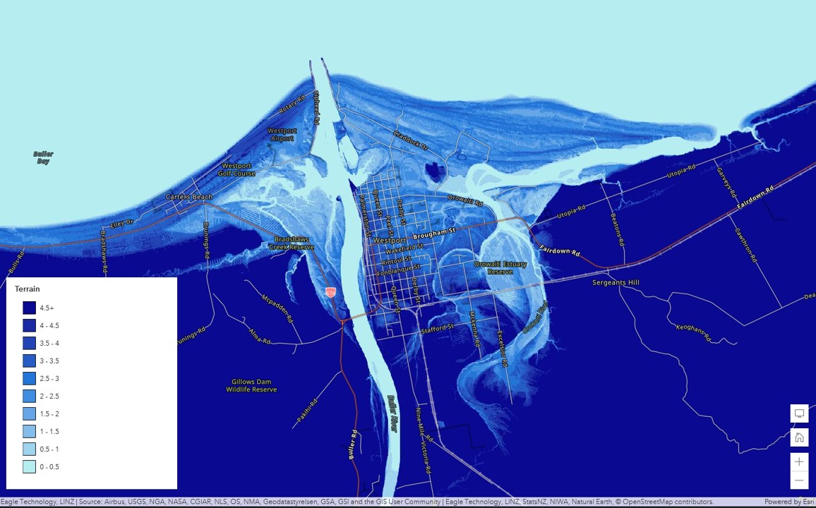
    New Zealand elevation data in Esri’s World layers

    The Terrain Dynamic Image service from Esri also includes the New Zealand elevation data. All the datasets will find its way to this layer as well as to Esri’s other derived layers like the Terrain 3D (Esri Elevation layer) and the various Hillshades all in Web Mercator. It can take a few months before the datasets make into Esri’s layer, due to their release cycle. A good read on the latest update on Esri’s elevation layers can be found here.

    Esri terrain layer visualized in classes

    For any questions on these layers or other Living Atlas content, please reach out to us at livingatlas@eagle.co.nz.

  • The Next Generation of NZ Basemaps are Here: Vector Basemaps in NZTM!

    The Next Generation of NZ Basemaps are Here: Vector Basemaps in NZTM!

    Following two beta versions earlier this year, we are now very excited to announce that the full version of the new NZ Topographic Basemap is now released.

    This is the first of our next generation of Basemaps: Vector Basemapswhich are cached and delivered as vector tiles and are rendered client-side based on a style file that is delivered with the vector tiles. Like all of our existing NZ Basemaps which it complements, the new Basemap is delivered in the NZTM projection and will align with your NZ data.

    You can find the new Basemap layer and the associated WebMaps along with versions which include hill-shading in this group (we recommend joining this group as we will be adding all of the new vector styles to this group also) as well as this nice StoryMap.

    The NZ Topographic Map’s style is based on the World Topographic map from Esri and is a great way to enhance your existing and new maps. Early in the new year, we will also be releasing more styles as vector Basemaps like the Canvas maps, Navigation map and a hybrid style that can be overlaid with the NZ Imagery Basemap.

    New to Vector Basemaps? Check out some background information below…

    Why use Vector Basemaps?

    Vector Basemaps have some significant benefits over raster Basemaps:

    Crisp – Because vectors are delivered to the client, the Basemaps always look crisp, also on high resolution devices and down to the lowest zoom level.

    Labels – More and more apps allow for map rotation. With vector Basemaps, your labels will rotate with the map, making them easy to read regardless of the bearing of your map.

    Size – Vector Basemaps are a fraction of the file size of raster Basemaps. This makes it easier to take the maps offline. Taking the whole of New Zealand offline is now easily possible. To support this, we will start sharing the vector tile packages that can be used to be side loaded onto your mobile device or to be used in Mobile Map Packages where you can combine the Basemap with your own data and take everything offline.

    Style – A great benefit of vector tiles is that they give you the ability to style the Basemap to meet your cartographic needs. This can include turning layers off that you do not require, changing the symbology of features, change the font and appearance of labels or changing the visibility range of select layers. Once you are satisfied with your changes, you can save the edited style to use as a Basemap in your maps and apps.

    NB To make it easier to change the style of a vector Basemap, Esri has released the Vector Style Editor that gives you a nice user interface to change the style of any vector Basemap. You can access the Vector Style Editor from the ArcGIS Online Map Viewer or you can start it from here. See this blog post on the Vector Style Editor for more information.

    How to use Vector Basemaps in your Organization?

    By default, your organization uses a Basemap gallery set by Esri. You can configure your Basemap gallery if you have administrator privileges in your organization. For example, you can combine raster and vector Basemaps, Web Mercator and NZTM Basemaps or you can create a completely custom Basemap gallery with custom Basemaps (e.g. authored by you), Eagle Basemaps and Esri’s Basemaps. A good blog about how to configure the Basemap gallery for your organization can be found here.

    The existing Eagle Basemaps are incredibly popular and we think our new Vector Basemaps will be even more popular so go make some awesome WebMaps and as always we really value your feedback at livingatlas@eagle.co.nz.

    References

  • WE’RE ADDING MORE ZOOM LEVELS TO THE NEW ZEALAND BASEMAPS (AND MAKING SOME CHANGES)

    WE’RE ADDING MORE ZOOM LEVELS TO THE NEW ZEALAND BASEMAPS (AND MAKING SOME CHANGES)

    Please Note that this change has been postponed until later this year, please watch this space for more updates. The New Basemap Schema described below is availabe in the meantime on the following URL for testing purposes:

    https://services1.arcgisonline.co.nz/arcgis/rest/services/


    Beneath every engaging WebMap, lies an unsung hero: a Basemap providing a background of geographic context for all of the content in your maps…

    Eagle Technology offers a range of Basemaps in the New Zealand Transverse Mercator (NZTM) Projection that you can choose from when you create a new map. These Basemaps are used by hundreds of organisations across NZ, with the most popular of the bunch being the New Zealand Imagery Basemap, one which is updated regularly with the latest publicly-owned aerial imagery. Over the years, we have seen the usage of our Basemaps grow, and in those years, the requirements of our users have changed. That is why we’ll be making some changes to our existing Basemaps.

    As part of its definition, every Basemap has rules to say how far you can zoom in and out in most of the apps and over the years we have received requests to allow for more zoom levels to support different use cases.  A couple of years ago we have added more zoom levels to our imagery Basemap, which now zooms in to 1:282. 

    At 4pm this Wednesday 18/12/19 we will be expanding the zoom levels even further for all our Basemaps. We will add levels to the smaller scales (to allow you zoom further out beyond NZ coastlines) and more importantly add new zoom levels to the larger scales (for zooming right in). The smallest scale will be 1: 591,657,527 and the largest scale will be 1:70. For the new larger scale zoom levels we will be using a technique called resampling, that means you’re basically zooming into the image of a smaller scale. This means that for those levels, the map will not look as crisp, but it does allow you to zoom in when you need to (such as to look at detailed feature layers which lie on top of the Basemap).

    For almost all the maps and apps this will be a smooth transition. After you reopen ArcGIS Pro or ArcMap or refresh the web page, you’ll be able to make use of the new zoom levels. There are a few to things to be aware of:

    • In ArcMap you may need to refresh your local display cache if you don’t see the Basemap showing up. Here you can read how to do that.
    • If you have your own cached maps, that uses the same zoom levels as one of our Basemaps and you have overlaid that map with one of our Basemaps current zoom levels they will still work in almost all the apps except for 3D web scenes. If you want to overlay you own maps with our Basemaps in the 3D scene viewer please re-cache your maps using the new tiling scheme, that can be found here
    • If you have a web application which explicitly requests a specific tile level e.g. tile level 0 then this may now result in a you initially viewing a different extent (i.e. zoomed out much further). This can be addressed by changing the requested zoom level to be 5 levels higher than previously e.g. zoom level 1 becomes zoom level 6. NB for a finite period of 3 months, we will have the old basemaps available on a different URL. Please contact gissupport@eagle.co.nz for more information.

    Please note that separate to the zoom level changes, we have found that some users still use a very old URL to access our Basemaps. In order to ensure a high quality ongoing delivery of our Basemap services, and to aid with the transition, we will be turning that URL off. If you still use that URL, please switch to the official URL as per below:

    As stated, we don’t expect any down time apart of these changes, but some minor disruptions may occur. If you have any questions about the upcoming change, please get in touch with us on livingatlas@eagle.co.nz.

    References

  • Crisp, New Imagery for Canterbury

    Crisp, New Imagery for Canterbury

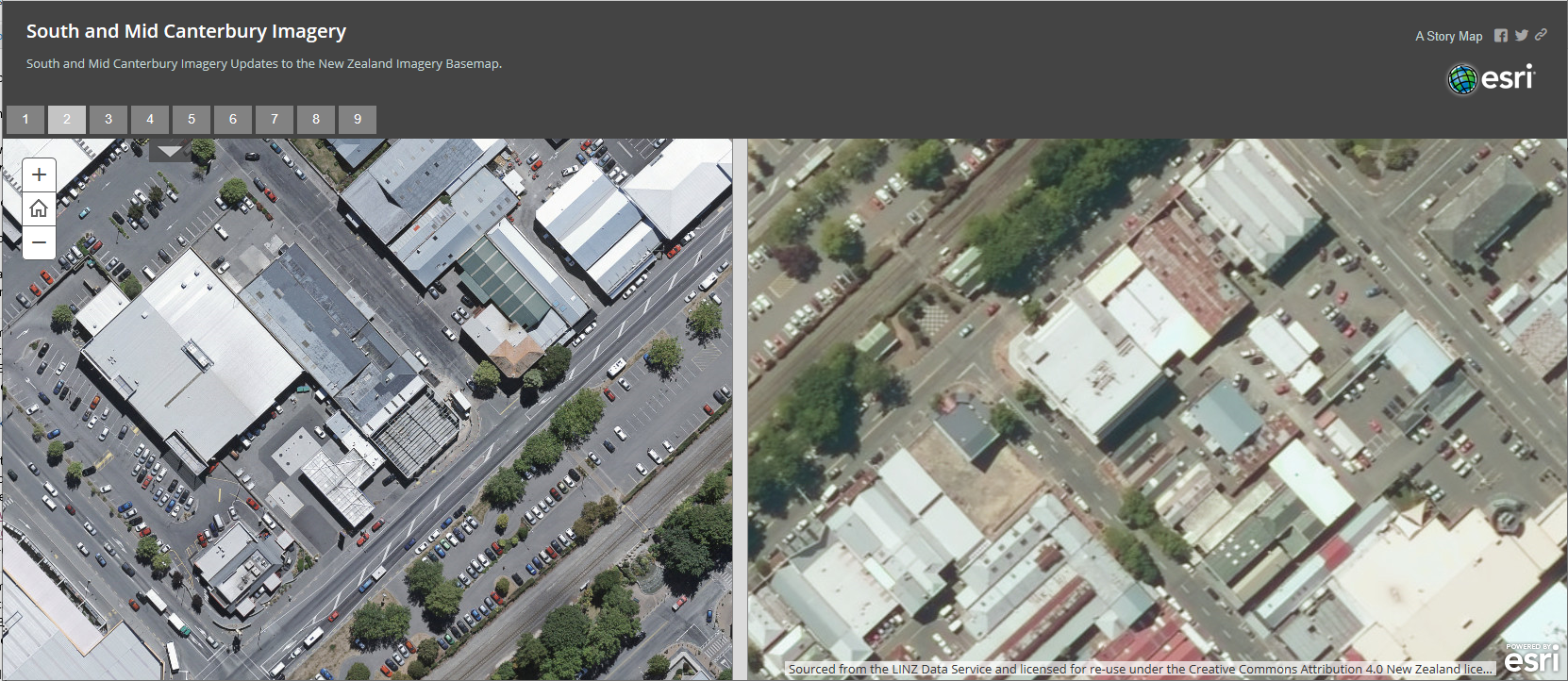
    Earlier this year we updated the NZ Imagery Basemap to add some fantastic detail to both Urban and Rural Mid and South Canterbury. This is part of the ongoing work done by Land Information New Zealand and their collaboration with councils and other public bodies to capture fresh, high resolution imagery and make it available under creative commons licencing.

    The imagery is live in our basemaps already and will be coming to the global Esri Basemap shortly too. However we are so excited to show off the imagery and we have created an ArcGIS StoryMap to highlight these updates which can be viewed here.

    The great thing is that these imagery updates will just continue to roll out and so in the near future we will be incorporating updated imagery for Marlborough, Gisborne and Tauranga. Watch this space for more updates.