Tag: GIS in Schools

  • Geospatial Professionals help schools teach GIS

    Geospatial Professionals help schools teach GIS

    Inspire Fascination, Invoke Curiosity, Spark Interest

    More and more geospatial professionals are helping schools around New Zealand to introduce GIS in the classroom.

    Some of the ways geospatial professionals are helping include:

    • Talking to a class about what they and other geospatial professionals do with GIS in their job
    • Providing technical assistant in a classroom where a teacher is utilising GIS
    • Providing geospatial data to a teacher to help them write lessons for their classroom utilising GIS
    • Hosting groups of students at their organisations on GIS Day

    To become a Geomentor you can register at http://www.eagle.co.nz/geomentors. Registering on this website is via a Survey123 for ArcGIS form that fires an email notification to the appropriate people at Eagle Technology when you click submit :). For more information on how to do this listen to the following Esri Training Seminar

    Automate e-mail notifications with Survey123 for ArcGIS

    One of the things that a geomentor needs to understand is how GIS currently fits into the NZ Schools curriculum. For those of us who went through the New Zealand school systems under School Certificate, Sixth Form Certificate and University Entrance it can take us a wee bit of time to get our heads around the “new” system. So below is a wee cheat sheet.

    • NCEA Level 1 is usually undertaken at the same level as School Certificate, this year is now called Year 11 not Form 5!
    • NCEA Level 2 is usually undertaken at the same level as Sixth Form Certificate, now Year 12
    • NCEA Level 3 is usually undertaken at the same level as University Entrance, now Year 13

    GIS is officially part of the Geography Curriculum at NCEA Level 1, 2, and 3. Neither Geography nor the GIS standards are compulsory at these levels of NCEA.

    GIS can be used in other years at school, including primary school but it often depends on the passion of the teacher, whether they in enjoy utilising technology and / or see the value of spatial thinking.

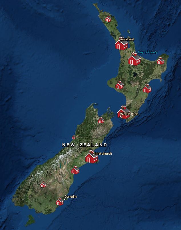
    Currently just under 200 schools in New Zealand are utilising ArcGIS Online in some way, check out whether a school near you is at https://www.eagle.co.nz/gis-schools and volunteer to be there Geomentor 🙂
  • Auckland – Teachers upskill in ArcGIS

    Auckland – Teachers upskill in ArcGIS

    Claire Thurlow – GIS Training and Education Manager

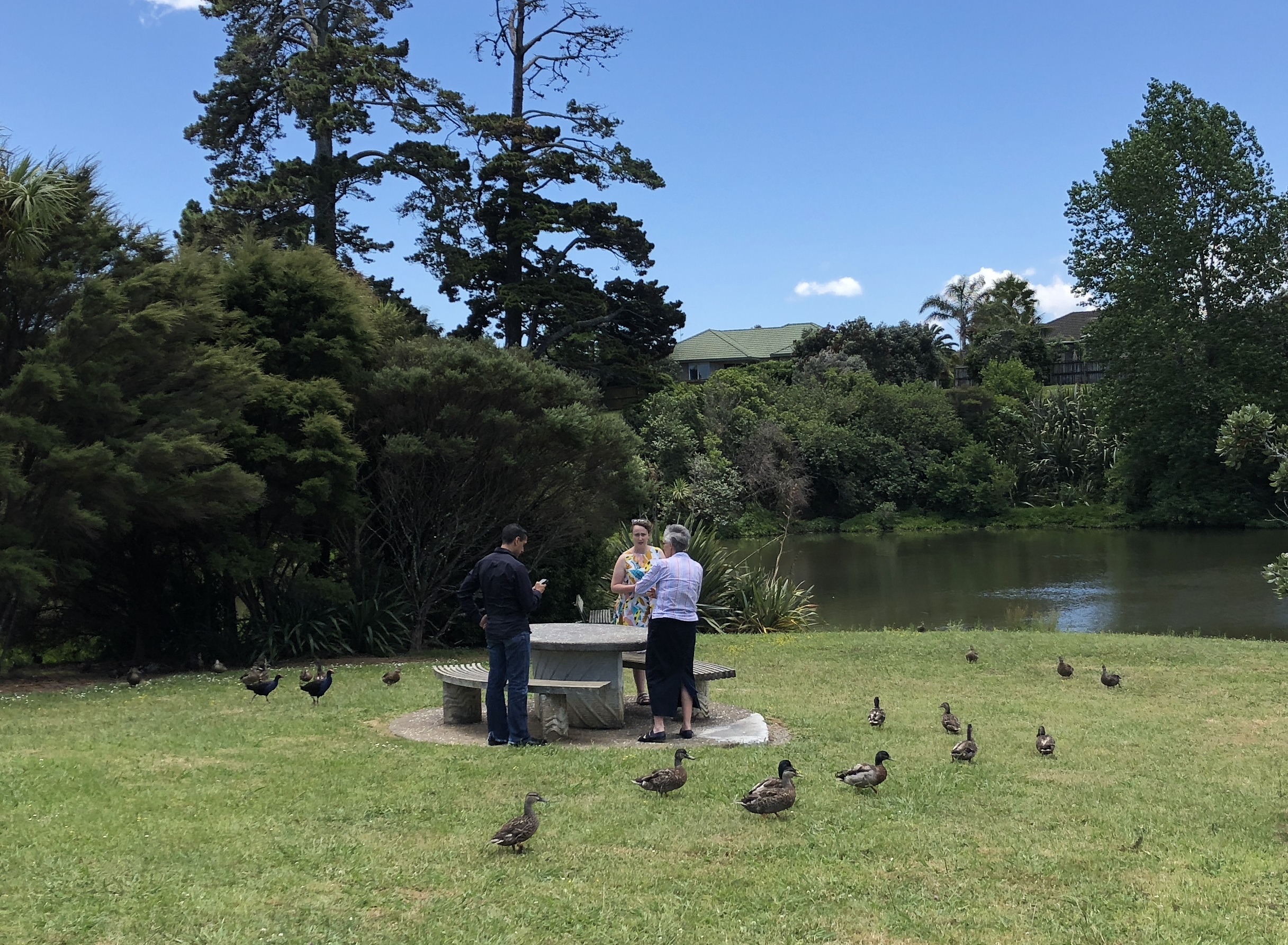
    In early December, Zorko Sostaric and I, travelled to Botany Downs Secondary School in Auckland to enable a group of Auckland based teachers to use GIS in their classroom in 2018.  ArcGIS Online and several of the apps that are included with an ArcGIS Online subscription were covered. There were five schools represented in the room and in most cases there were multiple teachers from a school attending.

    We had a mix of abilities in the classroom. Some of the teachers had used ArcMap in the past so wanted to translate their skills to ArcGIS Online. Some of the teachers had learnt the basics of ArcGIS Online and wanted to know more. While others were total newbies to ArcGIS Online having managed to activate their schools ArcGIS Online account but not much more. We therefore, started out simple and all the teachers created some map notes on a web map reflecting the tasks set out in the ArcGIS Online basics – Editing school lesson. We then ran through how to locate and add layers of information from ArcGIS Online into a web map and then let people loose to have an explore for data they thought they could use for lessons in the classroom. This data ranged from spatial information about the Great Pacific garbage patch, to Census data for New Zealand, to the most recent earthquakes in New Zealand and the world.

    We also had a look at the Geoinquiries localised to the New Zealand school curriculum that are available at the bottom of the http://www.eagle.co.nz/gis-schools page.

    Just before lunch, we broke out Survey123 for ArcGIS and created a simple survey that enabled us to collect the location and some basic information about benches around the school. We then quartered the school, split into groups and escaped the classroom with our devices to capture some ‘real’ data. After about a 20 minute field trip we returned to the classroom to view our data in a web map and to have an interesting discussion about the quality and precision of the data captured. In the end it all came back to the age old question of how good is good enough for data accuracy?

    Once back from a late lunch we took a stroll through Story Maps (both worldwide and local) and discussed how they could be used in the classroom by teachers and / or students.

    As our final task of the day we plunged into the NCEA level 1, 2 and 3 resources available on the GIS in Schools website

    NCEA Level 1
    NCEA Level 2
    NCEA Level 3

    A big thank you to Sally Brodie for organising this event and Botany Downs Secondary College for hosting us in December.

    #NZGISinSchools

  • Wellington – Teachers upskill in ArcGIS

    Wellington – Teachers upskill in ArcGIS

    Claire Thurlow – GIS Training and Education Manager

    On 27 October, it was a privilege to host 11 teachers from around New Zealand (but mostly Wellington) at Eagle Technology House. The day was dedicated to enabling the teachers to upskill in ArcGIS Online. There were seven schools represented in the room and in some cases there were multiple teachers from a school attending.

    Most of the schools represented on this training were exploring options for introducing GIS into their classrooms in 2018. So we started out simple and all the teachers created some map notes on a web map reflecting the tasks set out in the ArcGIS Online basics – Editing school lesson. We then expanded to adding layers from ArcGIS Online to the map for example the New Zealand Deprivation Index layer. This layer always generates a good discussion about why certain areas, such as the CBD in Wellington, appear as deprived in the map!

    We then took a stroll through Story Maps (both worldwide and local) and Geoinquiries localised to the New Zealand school curriculum that are available at http://www.eagle.co.nz/gis-schools. Then we plunged into the NCEA level 1,2 and 3 resources available on the GIS in Schools website

    NCEA Level 1
    NCEA Level 2
    NCEA Level 3

    This generated some interesting discussions about other topics that could have lessons developed around them. These topics ranged over the following topics:

    • sustainability topics,
    • the use of GIS in conservation
    • freedom camping
    • water quality
    • zombie attacks
    • sports related topics
    • snow / glacier melt – climate change 

    Давайте познакомимся с самой крупной на Земле (а точнее в воде) рыбой - китовой акулой. Сколько весит и живет китовая акула смотрите по ссылке.

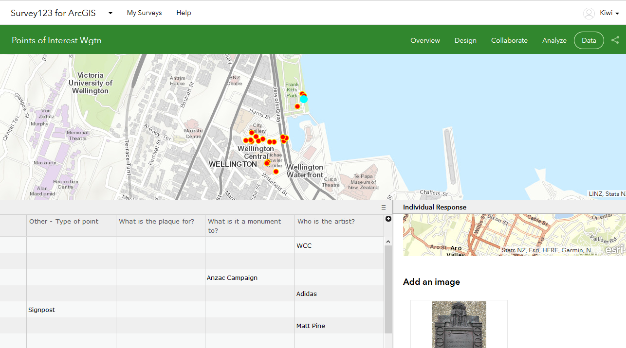
    Late in the afternoon we broke out Survey123 for ArcGIS – available with a schools ArcGIS Online account. We created a simple survey that enabled us to artwork, plaque and monument locations in Civic square and the Wellington Waterfront. We then took our devices out into the stunning Wellington sunlight to capture some data. You can see a view of some of the data we captured at the top of this blog. I think the data quality issue might come up again in the classroom after capturing data in the field!

    All in all a very successful day and Eagle looks forward to hearing the success stories that come out of the classroom.

    #NZGISinSchools

  • Dunedin – Teachers upskill in ArcGIS

    Dunedin – Teachers upskill in ArcGIS

    Claire Thurlow – GIS Training and Education Manager

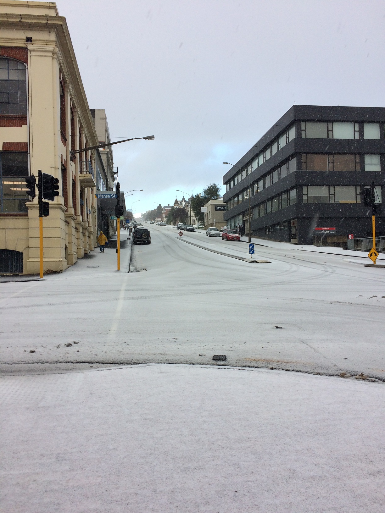
    Through snow, hail and ice they came to learn more about GIS and how to utilise GIS in the classroom.

    It was an absolute privilege to spend two days at Kaikorai Valley College helping teachers from throughout Dunedin expand their skills in the use of GIS in the classroom.

    At the start of the first day the teacher’s knowledge of GIS ranged from not knowing exactly what GIS was to teachers who had worked with primary school children and Collector for ArcGIS to capture data for mapping purposes on the Kaikorai Valley College urban farm.

    By the end of the first day all the teachers knew the following:

    We took Collector for ArcGIS out and about the school on the first day which posed some interesting challenges considering there was snow and ice on the ground! It also identified some real learnings about spatial data capture and data quality.

    The second day focused specifically on helping the staff at Kaikorai Valley College create a lesson that they could use in Geography at NCEA level 2 and 3. This lesson was based on the geolocated elemental breakdown of soil data captured by Simon Cox from GNS Science in 2016 on the Kaikorai Valley College urban farm. In the lesson students will

    • manipulate the data so it can be added into an ArcGIS Online Web Map (each student will have one or two different elements to display in a map)
    • run a query / filter on the data so that their map shows only those points that are within safe boundaries for farming
    • change the symbology of the map to better represent any patterns they see in the data
    • describe the pattern that they see
    • explain why an area might be good or not for planting a particular plant or housing a particular animal – solving a geographic problem
    • try and represent the points as a surface by using the ArcGIS Online Analysis tools – challenge for more advanced students.

    A big thanks to Simon McMillian for organising this event despite the weather challenges and to representatives from GNS Science and the University of Otago Surveying School who added their knowledge and skill to the first day.

    Lessons learnt

    • Having a class suite of smart devices to enable data capture in the field using Esri products is a fantastic idea.
    • Getting your Science department involved with GIS brings a whole new dimension to GIS in your School – cross curriculum GIS activities are an extremely rich learning environment.
    • If teachers are committed to expanding their knowledge to further the tools they have in their teacher toolbox they will come!
    • Maybe winter in Dunedin is not a great time to schedule a teaching training event which has an outside component!

    #NZGISinSchools

  • Tauranga – Teachers upskilling in ArcGIS

    Tauranga – Teachers upskilling in ArcGIS

    Claire Thurlow – GIS Training and Education Manager

    On 28 June it was an absolute privilege to travel to Tauranga and assist a number of teachers in the Bay of Plenty area to upskill in ArcGIS Online. There were five schools represented in the room and in most cases there were several teachers from each school attending.

    We started the day off with a round table discussion about where people had got to in implementing GIS in their classrooms. Many were in the same boat they wanted to use GIS in the classroom but didn’t know where to start.

    This sentiment guided the day. We started out simple and all the teachers created some map notes on a WebMap reflecting the tasks set out in the ArcGIS Online basics – Editing school lesson. We then expanded to adding layers from ArcGIS Online to the map for example the New Zealand Deprivation Index layer. This layer generated some good discussion around the meaning of data and other geographic concepts you could teach around GIS and spatial data.

    Once the teachers had saved their maps we progressed to look at some of the geoinquiries localised to the New Zealand school curriculum that are available http://www.eagle.co.nz/gis-schools. We also explored the new Maths geoinquiries just released by Esri for the benefit of our sole Mathematics teacher in the room. This lead naturally into a discussion on NCEA level 1,2 and 3 resources available on the GIS in Schools website

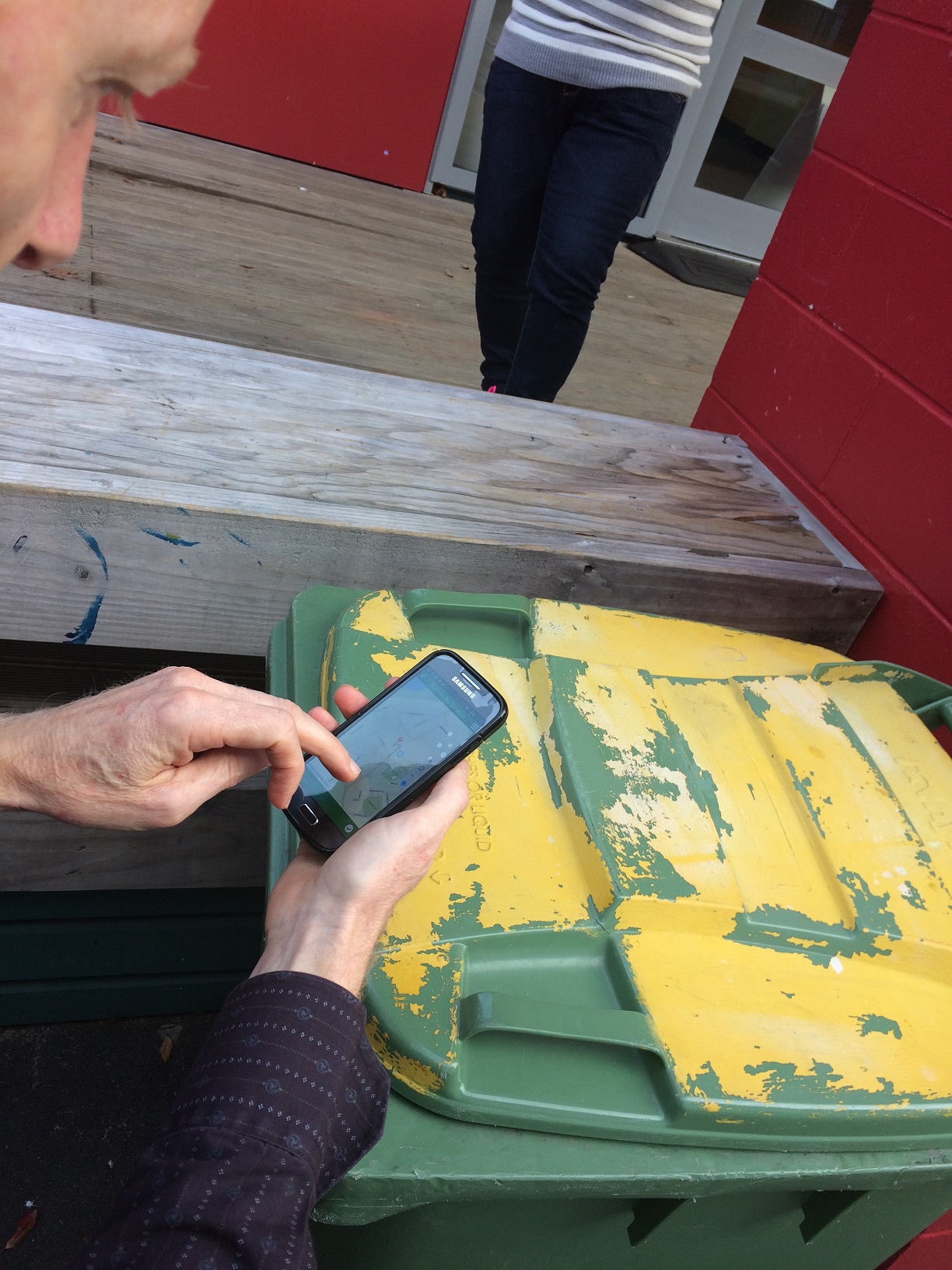
    We then ramped it up a notch and broke out Survey123 for ArcGIS – available with a schools ArcGIS Online account. We created a simple survey that enabled us to capture rubbish bin locations around the school and then we took our devices to the field to capture some data. Once the teachers got the hang of capturing data in the Survey123 App they were off capturing rubbish bin locations…when we returned to the room we explored our data capture results and discussed how Survey123 for ArcGIS could be used in their teaching. Some ideas were:

    • Capturing Graffiti locations, including a picture, around a city and analysing the results for urban patterns achievement standards
    • Capturing litter locations on the Tongariro Alpine Crossing as part of the large natural environments achievement standards
    • Connecting to the Digital Technologies curriculum
    • Using Survey123 as a tool to help inspire learning especially in the Geography lesson that is last thing in the day on a Thursday or Friday.

    All in all a very successful day and we look forward to hearing the success stories that come out of the classroom!

    Thank you to Bay of Plenty In-Service Training (BIST) for organising / sponsoring the day and Otumoetai College for hosting us all.

    #NZGISinSchools

  • GIS in Schools program expands

    GIS in Schools program expands

    [vc_row][vc_column][vc_column_text]Claire Thurlow – GIS Training and Education Manager

    The New Zealand GIS in Schools program is set to expand with Eagle Technology launching the Esri Program for Schools in New Zealand. The Esri Program for Schools was announced by Mark Allan, CEO, Eagle Technology, at the Auckland Esri Regional User Conference 29 March 2017.

    Students in both primary and secondary education in New Zealand now have free access to Esri’s ArcGIS Online software, which is a part of a roll-out of a multimillion dollar enablement program to schools across America, Europe, Australia and New Zealand. ArcGIS Online lets students and teachers explore and analyse data using maps.

    Eagle Technology, distributor for Esri in New Zealand and the South Pacific, has adapted twelve exercises, or ‘geoinquiries’, for the New Zealand education curriculum to add to the existing resources already available.

    Teachers can access instructional materials for using ArcGIS online, and students can explore data related to topics including World Population, Tropical Storms and Landforms and National Parks.

    To learn more about the Esri Program for Schools access: http://www.eagle.co.nz/gis-schools #NZGISinSchools.

    Feel free to email gisinschools@eagle.co.nz if you have any further queries about the New Zealand GIS in Schools program.

    Eagle CEO Mark Allan intro @ the @NZEUG Auckland #RUC pic.twitter.com/hsub1jcUdZ

    — EAGLE GIS (@eaglegis) March 28, 2017

    [/vc_column_text][/vc_column][/vc_row]