Category: General Updates

  • Trusted Geospatial Intelligence for Better AI-enabled Decisions

    Trusted Geospatial Intelligence for Better AI-enabled Decisions

    Artificial intelligence is moving rapidly from experimentation into enterprise strategy. Across sectors, organisations are under pressure to understand where AI can improve productivity, automate workflows, and support faster decision-making.

    But as AI adoption increases, many organisations are also facing a more difficult question, how do we make AI useful, trusted, and grounded in the real-world context our decisions depend on?

    For Eagle Technology, this is where trusted geospatial AI has a significant role to play.

    People, assets, services, risks, infrastructure, resources, and events all exist somewhere. That ‘where’ shapes decisions every day, from where services are needed, to where infrastructure is exposed, to where communities are affected, to where investment should be prioritised.

    Yet many enterprise AI systems are not inherently spatial. They are not designed to understand geography, spatial relationships, proximity, networks, boundaries, terrain, exposure, or the context that location provides.

    That creates a significant gap, AI may be able to process information quickly, but without trusted spatial context, it can miss where risk is concentrated, how assets and communities are connected, what is exposed, and where action will have the greatest impact.

    AI can generate answers, summarise information, and automate tasks. However, without trusted location intelligence, it can miss the spatial context behind real-world decisions.

    This is where Eagle has a clear role to play. Eagle enables organisations to bring trusted geospatial intelligence into AI-enabled workflows, so decisions are not only faster, but better informed, more contextual, and grounded in the realities of place, assets, risk, infrastructure, and communities.

    The market needs clarity, not more AI noise

    The AI market is moving rapidly. New tools, agents, assistants, models, and platforms are emerging at pace. For many organisations, this creates both opportunity and uncertainty.

    Eagle sees this every day through our work with customers across New Zealand. Organisations are not simply asking what AI is; they are asking what it can do for the problems they are trying to solve. They want to know how AI can reduce manual effort, make trusted data easier to access, support better operational decisions, and extend the value of the systems and platforms they already rely on.

    There is pressure to act, but also pressure to act responsibly. Customers need clarity on what AI can do today, what is still emerging, what is safe to pursue, and where investment will create measurable value. They also need a practical path for connecting AI to existing governance, data, security, and technology environments.

    This is particularly important in the geospatial space, where many organisations already hold significant value in ArcGIS environments, spatial datasets, imagery, LiDAR, asset information, field data, operational layers, and location-based workflows.

    The opportunity Eagle has identified is not simply for organisations to adopt new AI tools.

    It is to make trusted capability more accessible, more useful, and more connected to the wider enterprise AI strategies organisations are now developing.

    This is where Eagle’s experience matters. Through our work across ArcGIS, spatial data, enterprise systems, and customer delivery, we understand both the value locked inside environments and the practical challenges organisations face when trying to apply AI safely and effectively.

    The opportunity is to bring those worlds together, connecting trusted spatial data, workflows, and location intelligence into AI-enabled environments in a way that is practical, governed, secure, supportable, and focused on real customer outcomes.

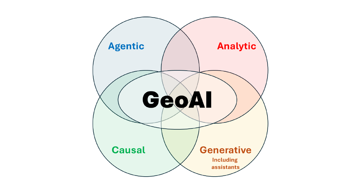
    There are two connected but distinct paradigms when thinking about Geospatial AI.

    The first is AI in GIS: the development of AI tools, assistants, automation, analytics, and capability within ArcGIS to support GIS users and enhance existing workflows.

    The second is bringing GIS to AI. This is where Eagle recognises the opportunity to support customers in bringing trusted spatial data, ArcGIS services, workflows, and location intelligence into wider enterprise AI environments.

    Both stories matter, and they complement one another. Together, they show how AI can enhance the GIS environments organisations already rely on, while also enabling trusted spatial data, services, and workflows to support wider enterprise AI strategies.

    Esri is continuing to develop native AI capability within ArcGIS. Eagle builds on that platform direction by translating emerging capability into practical, customer-ready solutions for New Zealand organisations.

    At the same time, we enable customers to bring trusted GIS capability into wider AI workflows, agents, enterprise systems, and business processes, so spatial data and location intelligence are not left outside the enterprise AI conversation.

    This distinction matters because customers are moving beyond the question of what AI can do inside a GIS platform. They are asking how trusted spatial data, ArcGIS services, and workflows can connect into the systems, processes, and operational decisions that already shape their organisation.

    For Eagle, this is critical, bringing location intelligence into enterprise AI so spatial data is not treated as a separate technical layer, but as a key part of how organisations make better decisions.

    From AI potential to trusted geospatial value

    Eagle’s position is clear, AI-enabled capability should be practical, trusted, business-focused, and grounded in measurable value.

    It should not be treated as a chatbot, a demonstration, or a technology experiment in search of a use case.

    The value sits in the full solution, trusted spatial data, strong foundations, clear governance, secure integration, practical workflows, reliable architecture, and ongoing support.

    Graeme Henderson, CEO of Eagle Technology, says, “The real value of AI in the geospatial space is not in applying new technology without a clear purpose. It is in helping organisations make better use of the trusted spatial systems, data and workflows they already rely on. Eagle’s role is to help customers apply AI and ArcGIS safely and practically, so they can improve productivity, surface new insights, and make more confident decisions in the real world.”

    That is the practical opportunity.

    AI can reduce manual effort, help people access information faster, identify patterns, support scenario testing, and make specialist capability easier to use across the business. But those benefits only become meaningful when AI is connected to authoritative information, aligned to governance, and designed around real operational needs.

    Graeme Henderson says, “Enterprise AI will only become more valuable when it is grounded in the real-world context organisations operate in. Location is a critical part of that context. Most AI systems don’t automatically understand where something is happening, how assets, communities, networks, and risks relate to each other, or why location changes the decision. Eagle’s role is to bring trusted GIS capability into AI workflows, so customers can move beyond generic outputs and make decisions that are more relevant, more contextual, and more operationally useful.”

    Where AI value starts

    For many organisations, AI value does not begin with an agent, assistant, or automated workflow. It begins with readiness: trusted spatial data, clear metadata, appropriate permissions, strong governance, and the confidence that AI-enabled workflows are drawing from information that is accurate, authorised, and understood.

    This is why AI-ready spatial data is a critical foundation. It reduces the risk of inaccurate outputs, disconnected analysis, or AI systems drawing on information that is incomplete, duplicated, outdated, or poorly understood.

    With those foundations in place, AI-enabled workflows can create value in practical ways. They can make authoritative spatial information easier to access through natural-language interfaces, support faster analysis of imagery, LiDAR, drone, sensor, video, mobile, and field data, and enable predictive analysis by combining spatial, historical, environmental, operational, and business information.

    This can help organisations detect asset changes, assess damage, monitor remote environments, understand future risk, test planning options, prioritise investment, and communicate decisions more clearly.

    With the right foundations and governance in place, AI-enabled workflows can extend the value of GIS across the organisation, giving non-specialists guided access to trusted spatial insight while enabling GIS specialists to focus on higher-value analysis, advisory, and decision support.

    Building capability that lasts

    AI capability cannot be treated as ‘deploy and forget.’

    Platforms will evolve, business needs will change, security expectations will mature, and governance requirements will become more defined. For AI-enabled capability to deliver lasting value, it needs to be designed from the outset to adapt, scale, and remain supportable beyond the first prototype or implementation.

    That is why maintainability is central to Eagle’s approach. Customers need AI capability that can grow with their business, adapt as ArcGIS and AI capabilities advance, and avoid being locked into a single version, workflow, or short-term implementation approach.

    Eagle’s role extends across the full AI journey: strategy and advisory, enablement, delivery, and long-term scale, operation, and maintenance.

    We work with customers to identify where AI can create measurable value, build the internal confidence needed for adoption, deliver practical and governed implementations, and ensure capability remains secure, resilient, supportable, and aligned to evolving business and platform requirements.

    The organisations that gain the greatest value from AI will not be the ones chasing every new feature. They will be the ones building trusted foundations now, so they can move faster, more safely, and with confidence as capability matures.

    For Eagle, this is the opportunity to protect and extend the value of customers’ ArcGIS and spatial data investments, bring trusted location intelligence into enterprise AI, and support better real-world decisions through AI that is practical, secure, explainable, and commercially sound.

    The future value of AI will depend on how well organisations can connect intelligence to context, systems to workflows, and technology to the decisions that matter. That is where trusted geospatial expertise becomes essential.
  • Unlocking Artificial Intelligence for Geospatial Professionals

    Unlocking Artificial Intelligence for Geospatial Professionals

    [vc_row columns=”1″][vc_column][vc_column_text]By Nathan Heazlewood

    Introducing Eagle Technology’s New eBook

    Artificial Intelligence (AI) is rapidly reshaping industries across the globe, and the geospatial sector is no exception. Yet for many Geographic Information System (GIS) professionals, AI can feel complex, opaque, and difficult to engage with meaningfully. Recognising this challenge, Eagle Technology has developed a comprehensive eBook designed to bridge the gap between AI theory and practical geospatial application.

    Why AI Feels Complex

    AI is not a single technology but a multidisciplinary field that draws on computer science, mathematics, and involves elements of cognitive science and ethics. At its core, AI involves creating systems that can learn from data and make decisions or predictions. However, achieving this involves a broad range of techniques and concepts—each with its own language and underlying theory.

    For example, AI includes different advanced methods like:

    • Neural networks: computational systems inspired by the human brain that recognise patterns in data.
    • Deep learning: a subset of AI that uses multi-layered neural networks to process complex data such as images or time-series information.
    • Transformers and attention mechanisms: modern techniques that allow AI models to focus on the most relevant parts of data, improving performance in tasks like language processing and increasingly, spatial analysis.
    • Generative models: systems capable of creating new data, such as predicting future scenarios.

    Each of these components introduces its own terminology and workflows, making AI feel overwhelming—particularly for professionals whose expertise lies in spatial analysis rather than data science.

    The GIS-First Approach: Strengths and Limitations

    Many GIS professionals naturally approach AI by starting with familiar tools and workflows. This “GIS-first” approach often involves applying AI through software platforms such as ArcGIS to solve practical problems, including:

    • Automated feature extraction from aerial or satellite imagery
    • Land cover classification
    • Predictive modelling for environmental or urban planning scenarios
    • Image segmentation (dividing imagery into meaningful regions)
    • Spatiotemporal analysis (examining how geographic patterns change over time)

    This approach has clear advantages. It delivers immediate, tangible results and allows practitioners to enhance existing workflows without needing to fully understand the underlying AI mechanisms.

    However, it can also create a dependency on specific tools and limit deeper understanding. Without a solid grasp of the principles behind AI, it becomes difficult to:

    • Evaluate new tools and claims critically
    • Adapt to rapidly evolving AI technologies
    • Design tailored solutions for unique geospatial challenges

    A Concept-First Approach to AI Learning

    Eagle Technology’s eBook takes an alternative approach—starting not with tools, but with foundational AI concepts. This method is designed to build a strong conceptual framework that GIS professionals can apply across technologies and use cases.

    The eBook introduces key ideas such as:

    • What defines a neural network, and how it processes data
    • The distinction between machine learning and deep learning, and when each is appropriate
    • Attention mechanisms, which help models prioritise relevant information
    • Bias in AI, which can lead to unfair or inaccurate results if not managed
    • Explainability, the ability to understand and justify AI-driven decisions

    By clearly explaining these terms in accessible language and within a sequence of structured categories, the eBook removes much of the intimidation often associated with AI.

    Connecting AI Concepts to Geospatial Applications

    Once these fundamentals are established, the eBook bridges the gap to GIS by demonstrating how AI concepts directly apply to geospatial problems.

    For instance:

    • Convolutional Neural Networks (CNNs), a type of deep learning model, are particularly effective for analysing raster data such as satellite imagery because they can detect spatial patterns like edges, shapes, and textures.
    • Reinforcement learning can be applied to optimise transport networks, dynamically improving route selection based on changing conditions.
    • Predictive models can forecast environmental changes, urban growth, or infrastructure demands using historical spatial data.

    This dual perspective—concept first, application second—equips readers with both understanding and practical insight. It empowers GIS professionals not just to use AI tools, but to understand why they work and how to apply them effectively.

    A Resource for Professional Growth

    The eBook is designed as a self-development resource tailored to the needs of geospatial professionals. It supports:

    • Building confidence in AI terminology and concepts
    • Enhancing technical literacy across emerging technologies
    • Enabling more informed decision-making in projects and investments
    • Supporting innovation in geospatial solutions

    At the same time, it serves a secondary audience: AI practitioners who want to understand how their techniques can be applied in the geospatial domain. By providing context and examples grounded in GIS, the eBook fosters better collaboration between data scientists and spatial professionals.

    Enabling the Future of Geospatial Intelligence

    As AI continues to evolve, its integration with GIS will become increasingly central to solving complex spatial problems—from climate change modelling to smart city development. Understanding AI is no longer optional; it is a strategic capability.

    Eagle Technology’s eBook offers a practical and accessible pathway into this evolving field. By focusing on foundational concepts and connecting them to real-world geospatial applications, it provides the knowledge needed to move beyond tool-based usage and towards true AI-enabled innovation.

    For GIS professionals looking to stay relevant, competitive, and forward-thinking, this eBook is an essential step in that journey.

    View and download Eagle Technology’s eBook, Artificial Intelligence Glossary: AI Key Concepts, Terminology and Geospatial Considerations.[/vc_column_text][/vc_column][/vc_row]

  • NZ Esri RUCs

    NZ Esri RUCs

    RUCs 2026 – Coming to a centre near you

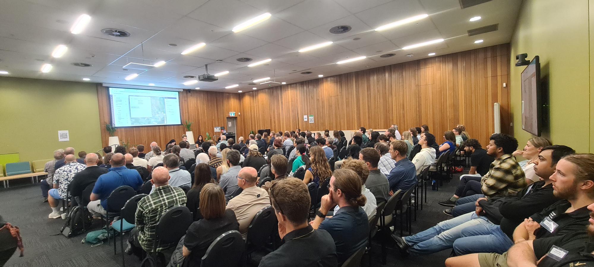
    This year’s 8-centre Regional User Conference series kicks off in Wellington on 23 March.

    Eagle Technology is once again collaborating with the NZ Esri Users Group to bring you the 2026 Regional User Conference roadshow.

    REGISTER NOW:

    Whangarei Distinction Hotel 21 April 2026
    Wellington National Library of New Zealand 23 April 2026
    Queenstown Queenstown Resort College (QRC) 29 April 2026
    Auckland The Grid 29 April 2026
    Tauranga Jordan Hall 30 April 2026
    Christchurch Black Box Theatre at Papa Hou 30 April 2026
    Blenheim Renwick Sports & Events Centre 5 May 2026
    Taranaki Novotel New Plymouth 5 May 2026

    Attendance is complimentary for NZEUG members, non-profits, students, and presenters.

    Attendance for non-members is $55. There are still a few complimentary tickets available for each venue. Be in quick to claim yours!

    Call for Abstracts

    We know our attendees love hearing GIS stories, whether big or small.

    Please submit your title and description through Submit Abstract.

    We hope you are as excited as we are to kick off the Regional User Conferences for another year – it is a great way to stay connected until the 2026 NZ Esri User Conference | 12 – 14 October at the New Zealand International Convention Centre.

  • Haukapuanui Vercoe – 2025 New Zealand Esri Young Scholar

    Haukapuanui Vercoe – 2025 New Zealand Esri Young Scholar

    I am incredibly honoured to have received the 2025 New Zealand Esri Young Scholar Award and to represent Aotearoa at the Esri User Conference in San Diego. I would like to extend my sincerest thanks to Eagle Technology and Esri for this prestigious recognition and the ongoing support of emerging researchers who are using GIS to address critical, real-world challenges.

    My project—Adaptations of Marae for Natural Hazards Resilience—sits at the confluence of civil engineering, geospatial science and Indigenous knowledge.

    By Haukapuanui Vercoe, Engineering PhD researcher

    I am incredibly honoured to have received the 2025 New Zealand Esri Young Scholar Award and to represent Aotearoa at the Esri User Conference in San Diego. I would like to extend my sincerest thanks to Eagle Technology and Esri for this prestigious recognition and the ongoing support of emerging researchers who are using GIS to address critical, real-world challenges.

    My project—Adaptations of Marae for Natural Hazards Resilience—sits at the confluence of civil engineering, geospatial science and Indigenous knowledge. Recent natural hazard events have recurrently seen marae play a key role in civil defence response, recovery and relief efforts, providing support and shelter for the community. As vital forms of sociocultural infrastructure, it is critical to better understand their exposure to natural hazards such as flooding, earthquakes or tsunami. Through spatial analysis alongside kaupapa Māori research methods, this work aims to enhance the climate, natural hazard and infrastructure resilience of marae. This award is particularly meaningful because it reflects academic achievement, but importantly the value of culturally grounded, community-focused research. I feel privileged to be working in a space where my whakapapa (genealogy), engineering background, and commitment to supporting marae-led adaptation efforts converge through tools like GIS.

    Showcasing this work at the Map Gallery in San Diego, alongside Young Scholars from around the world, was an unforgettable highlight. The conference provided unparalleled opportunities to learn from global leaders in spatial science, connect with professionals across diverse sectors and gain new insights into how GIS is supporting communities worldwide.

    One of the most meaningful aspects of the Esri User Conference was learning from the experiences of Indigenous communities across the United States. Hearing how they are harnessing the power of GIS to serve their people—whether through environmental stewardship, cultural preservation, or infrastructure planning—was inspiring and offered ideas I am eager to bring home.

    A group of people posing for a photo

AI-generated content may be incorrect.

    I was equally excited by the possibilities emerging from the integration of artificial intelligence with GIS. The ability to make processes faster, more accurate, and more connected—perfectly aligning with the conference theme, GIS: Integrating Everything Everywhere. Seeing these capabilities in action has sparked new ideas for how I might weave AI into my own current and future research.

    Attending the Esri User Conference was a truly transformative experience and I am deeply grateful to Eagle Technology for this opportunity. The manaakitanga (hospitality) shown by the Eagle Technology team, who made me feel so welcome and supported throughout the week, was second to none. I have returned home inspired by the scale and diversity of GIS innovation and more motivated than ever to continue supporting marae, whānau, hapū and iwi through applied spatial research

  • ArcGIS CityEngine Street Designer

    ArcGIS CityEngine Street Designer

    For years, urban designers and procedural modelers have faced challenges with the ArcGIS CityEngine Complete Streets rule—its complexity required meticulous parameter tuning, slowing down workflows. CityEngine 2025.0 Beta introduces Street Designer, a modular lane-based system that simplifies street creation, improves customisation, and enhances export flexibility for visualisation in game engines and 3D visualisation software.

    Background

    The design process for streets in CityEngine got a boost in 2015 with the publication of the Complete Streets rule. Developed by David Wasserman during his internship at Esri, this rule allows creation of complex street designs with the option for adding details like vehicles, pedestrians, streetlights and other street furniture, reporting options including painting, braking sight, object counts and more. While the Complete Streets rule offered extensive customisation, its sheer number of interdependent parameters made design workflows increasingly complex—requiring significant adjustments to achieve desired results. David wrote the unofficial user guide for this rule spanning 46 pages.

    After departing Esri, David continued updating his version of the rule on the Esri Community site until 2020. Esri’s official version of the Complete Streets rule is included in CityEngine example ‘Example Complete Streets’ and it is continually developed and maintained.

    Present Day

    A decade later, Esri revisited the design and shifted towards a simpler approach. The result is Street Designer. The Street Designer is a modular approach for simpler street design. In Street Designer a street is configured as a roadbed (centreline) and a number of lanes – road lane, bus lane, pedestrian lane, trees, lamps, furniture lane. For each lane, the user can apply individual rule and therefore the design is simplified. Instead of one large rule there is a number of smaller ones, easier to understand and modify.

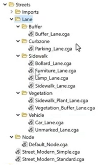
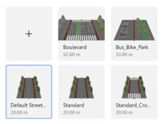
    As part of the transition to Street Designer ESRI.lib has new rules for different types of lanes as shown in the screenshot below.

    Street Designer implements a lane-based modular system. This structured approach enables transport planners to refine lane assignments and individual rules improving procedural modelling flexibility without relying on a single monolithic rule system.

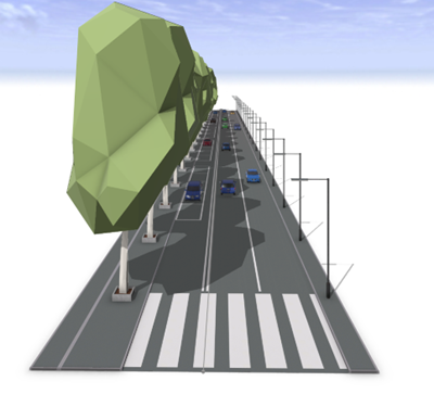
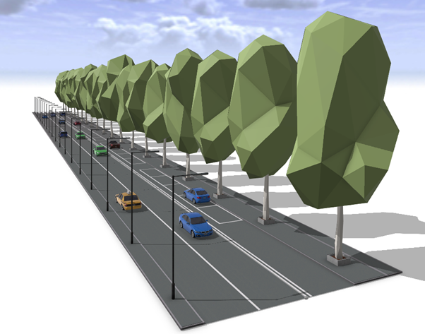
    Here is an example of the street designed in Street Designer.

    How to create a street using Street Designer?

    The design process consists of four steps:

    • Create a street using the Street Creation Tool
    • Add or remove lanes from Edit Lanes window
    • Assign rules individually, selecting rules from ESRI.lib for each lane enabling precise customisations
    • Modify attributes for lanes based on design needs

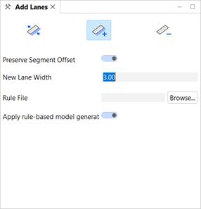
    The starting point is to use the standard Street Creation Tool and draw a street. Once the street is created, add lanes with the new Street Designer tool. This tool is easy to use, with visual cues where lane can be added. For finer control use the Edit Lanes window shown in the screenshot below.

    The next step is rule assignment. The new rules created for Street Designer are included in the ESRI.lib folder in current workspace. You need to apply rules to each lane individually.

    The final step is modifying the attributes for each lane. Each rule has different attributes providing fine grain design details.

    If you are working on a large area with many streets there is a lot of manual work and detailing with attributes. However, Street Designer has a feature called the Street Configuration that allows for the creation of a library of standardised street designs. These standardised street deigns can be applied to any street layout across multiple projects via the Street Configuration Manager providing visual feedback when necessary.

    Exporting

    With Street Designer, each lane can be exported as a separate set of objects. This modular approach simplifies asset replacement workflows, enabling users to substitute default objects with meshes optimised for game engines.

    Using Complete Streets rules meant you didn’t have access to street furniture, for example, as separate objects once street models are exported from CityEngine. This meant that users would need to create all details including benches, parking metres and streetlights or create placeholders and then replace them in the game engine with blueprints or higher quality assets.

    With Street Designer it is now possible to handle every lane separately and when exported they are exported as separate objects. This means that it is now a simple task to modify separate objects in applications such as in Unreal Engine with a blueprint that includes high quality mesh and light source with optional use of IES profiles. If you like the assets from CityEngine you can even use static meshes in your own blueprints for simpler workflow.

    This workflow improvement reduces time working in Unreal Engine significantly. Below is a street created with Street Designer, exported as a Datasmith file and then imported into Unreal Engine where the original streetlights objects were replaced with a simple blueprint containing a light source.

    Street Design in ArcGIS CityEngine

    Street Rendering in Unreal Engine

    For visualisation of larger areas or subdivision with numbers of streets and visualisation at night I would use Unreal Engine’s Megalights but that is a subject for another blog post.

    With modular street configurations, urban designers, city planners and game developers can refine workflows for maximum efficiency.

    How will you apply Street Designer in your next project?

  • Deprecation of the Classic New Zealand Basemap Server – Effective 5 May 2025

    Deprecation of the Classic New Zealand Basemap Server – Effective 5 May 2025

    As part of Eagle Technology’s ongoing work to provide up-to-date, high-performance basemaps compatible with current ArcGIS technology, we want to inform you about an important update to our basemap services. Please review the details below to ensure a smooth transition and optimal use of these basemaps in your work.

    – Boudewijn Boogaard

    Key Points

    • Deprecation notice: Starting 5 May 2025 Eagle Technology will deprecate our “Classic Basemap Server”.
    • Redirection: URLs referencing the “Classic Basemap Server” will be automatically redirected to the “Current Basemap Server” which hosts all of the same basemaps but with a different tiling scheme.
    • Users should Identify if applications are making use of the “Classic New Zealand Basemap server”: The attributes at the bottom of the page will show “Classic Basemap Server” if this is the case.
    • Migration Advice: If you identify that you are currently using the “Classic Basemap Server” then, based upon which specific basemap you are using, consider the following:
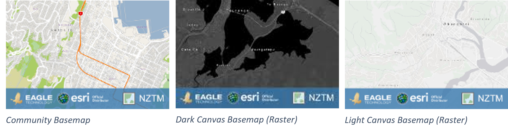
      • For users of the Community Basemap or the Dark Canvas Basemap (Raster), and the Light Canvas Basemap (Raster), see images below, these services have been in mature support since December 2022 on both the classic and current basemap server and no longer receive updates. We therefore strongly recommend transitioning to Vector Basemaps.
      • Manually migrating to the Current Basemap server or Vector Basemaps will allow proper testing and avoid potential disruptions.

    Background

    For over a decade, Eagle Technology has provided authoritative New Zealand basemaps in the NZTM projection to ArcGIS users. Over this time, significant advancements have been made, including:

    1. Introduction of Vector Basemaps; In December 2019 we introduced NZ Vector Basemaps, offering improved performance and functionality.
    2. Introduction of a New Basemap Server with a consistent tiling scheme; In early 2020 we deployed a new basemap server hosting the same basemaps, but with a consistent tiling scheme across all basemaps on that server for improved compatibility. The updated scheme includes:
      • 5 Additional small-scale zoom levels.
      • Larger scale zoom levels, enabling zooming to at least 1:70.
    3. Transition of Raster Basemaps to Mature Support in December 2022, as equivalent Vector Basemaps became available. This included both the Community Basemap and the Light and Dark Canvas Maps. See this blog for the announcement.

    What’s Changing?

    There are two basemap servers that host the same basemaps. The Classic Basemap Server hosts the basemap with different tiling schemes across the basemaps, the basemaps on the Current Basemap Server all have a consistent tiling scheme.

    We will redirect the URLs that currently go to the Classic Basemap Server to the Current Basemap Server.

    The basemaps on the Classic basemap server haven’t received any data updates since December 2022. The basemaps on the Current basemap server hosts basemaps that are in mature support, so they are also not receiving any updates, but the NZ Imagery and the LINZ Topographic basemaps are still being actively maintained.

    When you are using a basemap that is in mature support, we recommend migrating to one of the Vector Basemaps. Please read the blog with more information on this here.

    Scenarios That May Require Action

    While many users will experience a seamless transition, there are scenarios where adjustments may be required:

    1. Tiling Scheme Incompatibilities: Custom tiled layers aligned to the Classic Basemap tiling scheme may no longer overlay correctly. This mainly happens in 3D applications like Scene Viewer. The custom tiled layers must be re-cached using the new tiling scheme.
    2. Zoom Level Changes: Apps or URLs using specific zoom level IDs will require updates. For example, a zoom level ID of 14 on the Classic Basemap corresponds to ID 19 on the Current Basemap server.
    3. Cache and Map Updates:
      • In ArcMap: Clear the Display Cache.
      • In ArcGIS Pro: Reopen the map or project.

    Please note: These scenarios are not exhaustive, other issues may arise depending on your specific workflows or applications. We recommend thorough testing to identify and address any additional challenges.

    URLs Impacted

    The URLs that are currently directed to Classic Basemap Server and will be redirected to the Current Basemap Server are:

    • https://server.arcgisonline.co.nz/arcgis/rest/services
    • https://services.arcgisonline.co.nz/arcgis/rest/services
    • https://basemaps.cloud.eaglegis.co.nz/arcgis/rest/services

    Identify if a basemap from the Classic Basemap server is used.

    There are a few ways to identify if you are using a basemap from the Classic basemap server. You know it is coming from the Classic Basemap Server if:

    • the attributes, usually on the bottom of the map, says “Classic Basemap Server”.
    • the title of basemap layer item or the WebMap item has “Classic” in the name
    • the URL to the basemap is one of the impacted URLs

    These URLs will remain active but will be directed to the Current Basemap server.

    When migrating manually to the new server before the update, please use the services from this URL: https://services1.arcgisonline.co.nz/arcgis/rest/services

    Advised actions

    We strongly encourage users to:

    1. Identify all maps, layers, and apps that use basemaps that use the Classic Basemap server.
    2. Test and or migrate the layers to the Current Basemap server or a Vector Basemap.
    3. Update any hardcoded URLs or zoom-level parameters as needed.

    There are many ways to update the URLs depending on the situation.

    • Update the basemap in the WebMap by opening the webmap and selecting a current basemap as the new basemap for the map.
    • Update the group that holds the basemaps for the organisation’s basemap gallery. Remove the classic basemap webmaps and add webmaps with the current basemaps.

    A tool that can be helpful with updating maps and apps is the ArcGIS Assistant on https://assistant.esri-ps.com/. This tool allows you to update URLs in layers, maps and apps. Be sure to read the user guide to familiarise yourself with its capabilities.

    Basemaps in Mature support

    For users of CommunityDark Canvas or Light Canvas raster basemaps from either the Classic or the Current Basemap Server, we highly recommend transitioning to Vector Basemaps to benefit from the latest updates and support. These basemaps have been in Mature support since December 2022 which means that they have not received any data updates since then.

    HTTPS to be enforced for Eagle Basemaps

    For reasons of backwards compatibility, Eagle has allowed access to our raster basemaps using both HTTP and HTTPS. To stay in line with industry guidelines we will be enforcing HTTPS access only to our Eagle basemaps from July 2025. Any requests in HTTP will be redirected to HTTPS. In many cases the redirect will work, however there may be some specific cases where the redirect does not work, including some circumstances within custom developer applications. In these cases, the developers will need to update their applications and tools to accommodate HTTPS.


    Resources

  • Learning is a journey…

    Learning is a journey…

    In 2025 Eagle Technology is introducing an innovative new learning style entitled the Modular Application of Practical Skills.

    Learning is a journey but hopefully not a never-ending story…guess which movie I have in mind?

    One of the most significant leaps a person often makes in their learning journey is applying knowledge learned on an instructor-led course to real-world scenarios that are more transferrable to their day-to-day work. This transition can sometimes feel extremely daunting, whether limited by the constraints of the technical environment you work within or simply not being confident enough with your newly acquired skills. Eagle Technology aims to make this leap easier by introducing our new Modular Application of Practical Skills (MAPS) learning format.

    MAPS consists of a series of modules from which you can select one or more to complete at specific times during the year. Each module allows you to apply skills learned in an instructor-led course to a near-real-world scenario.

    Current module options are:

    • Designing and building a geodatabase.
    • Install and configure ArcGIS Enterprise on a virtual machine.
    • Creating a complex survey using Survey123 Connect.
    • Developing a web app with ArcGIS Experience Builder.
    • Building a data processing workflow using ArcGIS Data Interoperability.

    More modules may be added in the future and we’re open to feedback from the community on what is helpful.

    Let’s take the Design and Build a geodatabase module and unpack how it works.

    On the first morning of the module your instructor takes approximately half an hour to present you with a scenario including a few criteria that need to be fulfilled as part of design and build of a geodatabase. Independently, you need to decide:

    • what feature classes to include in your database,
    • what fields each feature class requires,
    • whether you need to apply subtypes and domains,
    • whether additional geodatabase functionality like topology or relationship classes is required
    • whether there is any other geodatabase functionality are necessary

    You then build the geodatabase that you have designed. You will have three concurrent mornings to complete the module with an instructor on call if needed. You can discuss your design and build process with other module participants. At the end of the final morning, you will present your geodatabase to your fellow participants and the instructor. You will obtain feedback on your geodatabase design as the final component of the module.

    The key features of MAPS are:

    • Scenario-Based Learning: Modules focus on realistic challenges to develop applicable skills.
    • Independent Work: Challenges encourage critical thinking and self-direction.
    • Instructor Support: An instructor will introduce a scenario module and have regular check-ins with the participants as well as being on-call outside of these times.
    • Deliverable-Focused: Each module requires a concrete output and finishes with a short presentation enabling other participants and the instructor to provide feedback.
    • Flexible Participation: Choose one or multiple modules, assigning them based on roles or needs. Each module is available twice yearly, with in-person or virtual options.

    MAPS bridges traditional learning and practical application, fostering independence while delivering actionable skills.

    Interested in registering for one or more MAPS modules? Here is some important additional information that you need to know:

    • MAPS modules are available for both individuals and organisations.
    • An organisation can choose different employees to attend different modules scheduled throughout the year.
    • MAPS modules need to be pre-purchased.
    • On purchase you will receive a voucher code and a link to register on MAPS.
    • Space on each module is limited, therefore registrations will be on a first-come, first-served basis.
    • MAPS modules can be attended virtually or in person at the Eagle Technology Wellington Education Centre (please note that the instructor might not be physically present at the Wellington Education Centre for all modules).
    • MAPS modules are only available during set times throughout the year and cannot be accessed outside these scheduled periods.

    Please talk to your Eagle Technology Account Manager or contact gistraining@eagle.co.nz to register for one or more Modules from MAPS.

    If you have any additional questions about this new learning format, please contact me (Claire Thurlow), via the gistraining@eagle.co.nz email address. 

  • GIS Managed Services – What is it?

    GIS Managed Services – What is it?

    Enterprise geospatial systems have become increasingly complex and require dedicated resources to maintain and optimise. This is where having a trusted Managed Services provider can help. At Eagle Technology our dedicated team, manages, monitors, and supports ArcGIS Enterprise and desktop environments in the Cloud – ensuring your system remains up-to-date, performant, and secure. You will no longer have to navigate complex back-end components and IT jargon, while also developing geospatial solutions for your business.   

    GIS Managed Services is a powerful enabler to advance your organisation’s geospatial capability, providing a solid foundation of GIS and IT expertise for your geospatial infrastructure and allowing more time for key internal staff to focus on business outcomes and develop solutions that leverage this powerful technology.   

    At Eagle Technology we work with customers from across sectors – part of the journey to GIS Managed Services is identifying the right configuration of services to fit an organisation’s needs. We have a range of modular reference architecture and cloud expertise to design solutions that are cost-optimised, secure, scalable, and performant. These are built with maintainability in mind and utilise industry-standard automation for efficient implementation and reducing project risk and downtime.   

    Moving to the cloud is not without challenges but we work with you every step of the way to design, plan, implement, and manage your cloud transformation journey towards a successful outcome.     

    The 9 Benefits of GIS Managed Services   

    Faster build times
    Building and configuring cloud infrastructure is faster than on-premise because there is no need to procure and install dedicated IT infrastructure. To achieve a rapid and efficient build practice, we use automation such as Infrastructure as Code (IaC) and Desired Sate Configuration (DSC) to deploy and manage environment changes.   

    Regular upgrades
    Keeping your system current and up to date is a key part of any well-maintained system, not only to remain secure but also to take advantage of new features and enhancements. Upgrading can be a burden and require a lot of effort but with GIS Managed Services our team takes care of that and ensures your system is upgraded efficiently every year so you can leverage the new enhanced features.   

    Built for easy scale and expansion
    Through GIS Managed Services, while we know that systems are built for an initial set of requirements, we also know that usage patterns and demands change over time. When the need arises, we are here to help, whether providing more storage or compute for a particular workload or implementing a whole new geospatial capability –  like empowering data scientists with Notebook Server capabilities or implementing cloud storage for imagery management workflow. We take pride in continuously providing the geospatial infrastructure to meet your business’s evolving needs.   

    Secure and compliant
    Ensuring your geospatial infrastructure complies with industry standards and your business data and workloads are secure is of utmost importance to us. Security best practice is a first principle of our design process and laying in procedures to maintain and improve security posture are key factors in our service offering. Cloud compliance tools are built-in to continuously monitor and report so our team can proactively access and analyse any potential threats or vulnerabilities.   

    Resilient
    GIS Managed Services leverages the redundancy built into cloud service offerings to provide >99.9 availability service levels for supporting infrastructure and lowering the risk of system impact due to a disaster affecting on-premise systems. Systems are designed to meet the organisation’s desired recovery point and time objectives and robust backup and disaster recovery procedures are implemented.   

    Accessible from anywhere
    In an increasingly mobile world, access to geospatial systems whether in the office, car, home, or middle earth is a must. Eagle allows secure access from any location your staff needs to operate from to support the remote worker and business continuity.   

    Transparent costs and management fees
    The true cost of running geospatial infrastructure is often hard to quantify but with GIS Managed Infrastructure costs are visible monthly and we provide accurate forecasts of expected fees. With a true pay-for-what-you-use infrastructure consumption model, cloud cost optimisation and savings can be found and actions taken, such as reducing up-time of non-production systems while not in use.   

    Free up valuable internal resources
    By removing the system management and administration overhead, GIS Managed Services frees up valuable resources to channel their skills on engaging with the business and geospatial capability to solve real-world problems. This leads to a higher return on investment and greater focus.   

    Retain system and technical knowledge through a trusted partner
    Investing in a trusted partner to manage and maintain your geospatial infrastructure ensures retention and consistency of service for critical systems. Our experienced team is dedicated to managing geospatial infrastructure to a high standard and partners with other Eagle business units and Esri to assist with future guidance and strategic decision-making.

  • Esri Regional User Conference events across Aotearoa New Zealand (aka 8 locations, 650 people, 400 organisations, and 1000 sausage rolls*)

    Esri Regional User Conference events across Aotearoa New Zealand (aka 8 locations, 650 people, 400 organisations, and 1000 sausage rolls*)

    On behalf of the teams at Eagle Technology and the NZ Esri User Group, we wanted to thank all the presenters, attendees, sponsors and hosts for making the 2024 NZ Esri Regional User Conferences (RUCs) such a success.

    Over the past few weeks, we have heard some amazing GIS stories from across the country as well as seeing both new and familiar faces within our amazing and growing GIS community.

    Providing the ArcGIS technical updates on what’s new and coming is part of these events and below we have shared some supporting information including links to some online resources that were covered at the events.

    However, it is the stories of GIS being used in the real world that were our main takeaway: from Establishing Crime Hotspots to creating Digital Twins of Kiwifruit, Apples and “Lemons”; from Predator and Pest Control operations in some of NZ’s most remote areas to Emergency Mgmt. Common Operational Platforms (Local and National); and from Keeping our native birds protected from Avian Influenza to Machine Learning and GeoAI in action.

    Thank you again to the community and we look forward to seeing you all at the NZ Esri User Conference (NZEUC) on the 23rd to 25th September in Tākina Convention Centre in Wellington (if not before of course).

    As mentioned, here are some Links & Resources shared from 2024 NZ Esri RUC events: 

    Finally, for those of who were unable to attend the RUC events in person, watch out for a post soon sharing videos of the event which were recorded at the Wellington RUC and which cover the Technology Update as well as some of the GIS Community Stories.

  • How do I estimate ArcGIS Online credit usage?

    How do I estimate ArcGIS Online credit usage?

    Learn some tips and tricks about how you can monitor credit usage for different activities across your ArcGIS Online organisation including individual member usage.

    Purpose of ArcGIS Online Credits

    ArcGIS Online credits are a form of currency used across the different ArcGIS products. These are consumed on specific transactions (e.g., Analysis Tools) and storing specific features. However, most activities in ArcGIS Online do not use credits (e.g., adding layers from the Living Atlas into a web map).

    Usage of Credits

    Credits in ArcGIS Online are consumed when there is a transaction-based tool being used. These include:

    • Performing Spatial Analysis Tools
    • Performing Imagery Analysis
    • Geocoding Points

    Furthermore, credits are used for storage. There are three types of storage that consume credits:

    • Feature Storage (such as feature layers hosted in ArcGIS Online)
    • Imagery Storage
    • File Storage (such as attachments in the hosted feature layer, files, and other layers)

    As an Administrator of an ArcGIS Online subscription, you want to keep track of the use of credits within your organisation. By monitoring credit usage, you can determine if it is necessary to:

    • reduce data storage,
    • reduce credit consumption,
    • plan for purchasing credits if required. 

    As an ArcGIS Online user, you can estimate the ArcGIS Online credits it would take to perform a transaction-based activity or to store specific data. This would benefit your organisation by ensuring credits are utilised to their full value.

    Estimating credit usage for performing analysis tools

    In the February 2023 ArcGIS Online update, there is a tool that allows an ArcGIS Online user to estimate the approximate number of credits needed to perform spatial analysis.

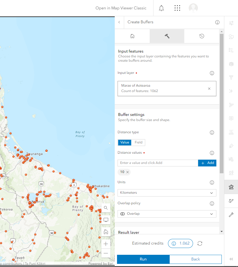
    Example: The Buffer Tool was used to create a 10km Buffer of each Marae in New Zealand (Data by Te Puni Kōkiri). It is estimated that 1.062 credits will be used to perform this analysis for all Marae across New Zealand.

    ArcGIS Online interface of Marae points in the North Island while using the Buffer Tool

    If you would like to reduce credit usage for a specific tool, you can limit the extent of your analysis to the map extent on your screen. This can be done using the display extent option in the environment settings of the buffer tool.

    ArcGIS Online Administrator – the February 2023 ArcGIS Online release does not allow you to change the default analysis extent globally to be the display extent.

    Estimating credit usage for storage

    As of April 2023, the feature storage charge cost is 2.4 credits per 10 MB stored per month and is calculated hourly.

    You can check the latest information about credit usage costs at the Esri ArcGIS Online site under ‘Credits by capability.’

    An ArcGIS Online Administrator can estimate the use of credits for storing features.

    Estimation Methodology

    As an Administrator, this methodology could help determine the number of credits used to store certain files.

    Example: This ArcGIS Online subscription has about 41.47 GB of feature storage. However, the cost of credits changes each day in the months of January and February in the new year.

    • Convert the Gigabyte (GB) to Megabyte (MB). Remember that 1GB = 1024 MB

    This equates to ~42465 MB

    • Calculate 2.4 credits per 10MB Stored each month.

    Divide the total of Megabyte by 10 = 4246.5

    • Multiplied by 2.4 credits per month for feature storage.

    This would be about 10,191.6 credits per month.

    • Results of Credit usage in months with different number of days

    Divide the total amount of credits per month to the number of days in the month.

    • January (31 days) = ~328 credits per day
    • February (28 days) = ~363 credits per day

    Credits are charged at a monthly rate; this means that the cost of credits differs each month. Therefore, the number of days per month impacts the cost of credits, even though the data size remains the same.

    Other resources

    Esri has additional resources available to explain ArcGIS Online credits.

    ArcGIS Online Credits – Storage (Video)
    Esri ArcGIS Online Credits (Web)
    Understanding credits (Help Page)

    If you need further assistance with understanding ArcGIS Online credits and their use, please contact your Eagle Technology Account Manager.