Author: eagle_managewp

  • First 2 Weeks at Eagle – Danielle

    First 2 Weeks at Eagle – Danielle

    Hi, I’m Danielle Spain and I am intern 1 of 3 this year at Eagle. During the two weeks I’ve been here so far I’ve learnt a lot. I have used ArcGIS Pro for the first time and explored some of the many uses of ArcGIS Online. One of my favorite apps was the Situational Awareness Viewer which allows you to make important information available in an easy to understand way. I was impressed with the amount of information that can be quickly summarized in it.

    I also made my first Story Map for the #NZGIS4EM Workshop. This is a Story Map Journal designed to facilitate a “stress test” for the Auckland Region (Shown above and available here). This helped to address questions like: What would happen if a volcano erupted in Auckland, what data would be needed, how would different agencies work together? 

    Working at Eagle has been really interesting and fun so far and I’m looking forward to what I get to do next. 

  • 2017 Esri Regional User Conferences – it’s a Wrap!

    2017 Esri Regional User Conferences – it’s a Wrap!

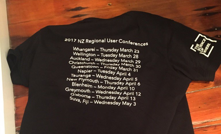
    The Eagle Technology team recently completed the Regional User Conference (RUC) tour covering 11 NZ locations, 1 Fiji location and over 700 delegates.

    We would like to take this opportunity to thank everyone who participated – presenters, organisers, networkers and delegates.  The feedback we’ve received is very positive and the events were a great success.
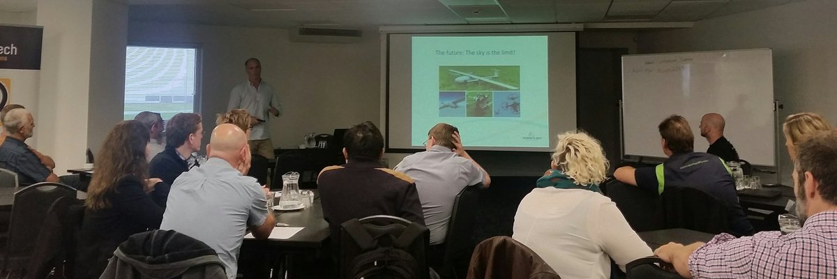
    Napier RUC Event

    Technical Resources
    A lot of technology information was shared at the RUCs, some of which may have been missed. Below is a list of resources you may find useful:

    A selection of videos based on RUC demonstrations including ArcGIS Pro, ArcGIS Online Collaboration, Insights for ArcGIS and others. 

    A Storymap illustrating how Sharing works using ArcGIS Online – a different, but equally interesting example to the one shown at the RUCs.

    A 3D Storymap outlining the benefits of 3D visualisation for Development when planning for growth, designing new developments or reviewing design plans in your community.

    Other Important Announcements

    NZ Basemaps – There is now an easier way to give us your feedback on the NZ Basemaps.  The Feedback App allows you to provide comments and suggestions so that the Eagle team can review and incorporate into upcoming releases.

    Living Atlas – Become part of the Living Atlas and to submit your data to the Esri World Stream Gauges layer.  This layer displays measurements recorded at Stream Gauges around the world and puts them into one convenient service, if you were interested in joining us in creating this across New Zealand please contact GIS Support

    Landsat Explorer Web App – Explore the planet more deeply with the Landsat Explorer web app. Use the app to both visualize our planet and understand how the Earth has changed over time. Now you can instantly analyse more than 500,000 Landsat 8 and GLS scenes, offering global coverage with over 500 new scenes added everyday. The web app is free, with no download or installation required.

    NZEUC 2017 – Call for Papers is open until May 26.  We saw many exciting and interesting presentations at the RUCs and we would like you to submit and share your work with the wider NZ community.  More information about how you can submit your abstract can be found here.

    Esri Training – This year, four RUC locations incorporated a day of Instructor led training pre or post RUC.  If you would like to know more about the training available for you or your organisation, email us or go to Eagle GIS Training.

    Feedback – If there is any other feedback you have about the RUCs please email the NZ Esri User Group or post a comment on the forum.

    We hope you find this additional information useful and we look forward to seeing you and sharing your work at the NZEUC in August.

    The Eagle Technology team

  • Fostering a love of maps

    Fostering a love of maps

    Author: Sarah MacDonald – Marketing

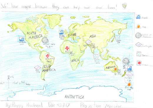
    Fostering a love of maps early may mean that our own Nathan Heazlewood is helping his children to follow in his GIS footsteps. We love that Poppy has won second place in the NZ Schools Map Competition. And she’s clearly excited about it herself. Well done Poppy.

    Article for School Newsletter by Poppy Heazlewood (Age 8)

    In March 2017 some of our school children including my class [Rm 10] and my sister and I entered the NZ Schools Map Competition. I did my map as a disaster map for where there have been fires and cyclones. I traced the outlines of the land and coloured in the sea and the land. I drew a key and other stuff like that for other things that have happened. Abby [my big sister] did different coloured text on a map that had blue text were the sea was and green were the land was. On one exciting Friday I awoke with a quiet voice saying get out of bed, for a second I had no idea what it was about, but then I got a very faint idea. I walked down the hall with my sister dragging behind me. I had a grin on my face. My Dad told me to look at the computer, at first I felt a little disappointed when I saw that Abby came first in 9-12 year old category and I thought that was what it was about, but when I read a bit more I felt like I was going to burst! I came second in the 6-8 year old category!!! Now our maps start all over again in the worldwide competition! They are being sent to Washington in the USA! I wonder when we will get our PRIZES!****

    Maps can be found here: http://www.cartography.org.nz/events/childrens-map-competition

  • GIS in Schools program expands

    GIS in Schools program expands

    [vc_row][vc_column][vc_column_text]Claire Thurlow – GIS Training and Education Manager

    The New Zealand GIS in Schools program is set to expand with Eagle Technology launching the Esri Program for Schools in New Zealand. The Esri Program for Schools was announced by Mark Allan, CEO, Eagle Technology, at the Auckland Esri Regional User Conference 29 March 2017.

    Students in both primary and secondary education in New Zealand now have free access to Esri’s ArcGIS Online software, which is a part of a roll-out of a multimillion dollar enablement program to schools across America, Europe, Australia and New Zealand. ArcGIS Online lets students and teachers explore and analyse data using maps.

    Eagle Technology, distributor for Esri in New Zealand and the South Pacific, has adapted twelve exercises, or ‘geoinquiries’, for the New Zealand education curriculum to add to the existing resources already available.

    Teachers can access instructional materials for using ArcGIS online, and students can explore data related to topics including World Population, Tropical Storms and Landforms and National Parks.

    To learn more about the Esri Program for Schools access: http://www.eagle.co.nz/gis-schools #NZGISinSchools.

    Feel free to email gisinschools@eagle.co.nz if you have any further queries about the New Zealand GIS in Schools program.

    Eagle CEO Mark Allan intro @ the @NZEUG Auckland #RUC pic.twitter.com/hsub1jcUdZ

    — EAGLE GIS (@eaglegis) March 28, 2017

    [/vc_column_text][/vc_column][/vc_row]

  • What’s New in LocalMaps (March 2017)

    What’s New in LocalMaps (March 2017)

    Lauren McArtney, GIS Local Government Consultant

    In the March update, LocalMaps has greater reporting capabilities, new Save Map and Draw Widgets as well as several bug fixes and enhancements to existing widgets. Later in the year, we will be releasing LocalMaps Version 2.0 –  check out below for more on what to expect!

    What is LocalMaps?

    LocalMaps is an extensible and easily configurable Web GIS solution designed to support common, simple Local Council workflows and which is complementary to the wider ArcGIS platform. 

    Key benefits

    • Easy to administer & configure
    • Configuration Map by Map (rapid deployment of maps)
    • Index LocalMaps Viewers as well as Web App Builder and ArcGIS Online configurable apps in the LocalMaps Gallery
    • Can be deployed as part of a larger implementation
    • Supported by Eagle as part of existing Licence with support for extension from partners
    • Extensible through widgets
    • Extensible through premium partner components

    Key features

    • Theme
    • Gallery
    • Focused viewers
    • Administration Tools
    • NEW! Reporting 

    New Features and Enhancements

    Reporting

    LocalMaps Reporting has a new look! The improved Reporting administration tab allows you to easily view, edit and create advanced reports.

    • Build multi-page reports from a single input feature
    • Include multiple maps and map layouts
    • Add maps, tables and text statements based on a selected feature and linked tables.
    • Move, order and reposition elements in the report
    • Configure buffers and other spatial features
    • Select from predefined templates or upload you own to ArcGIS Server to use.

    Save Map

    Save edits and selections made to any map with the new Save Widget. Saved maps can then be shared with others through a url. This functionality is currently only available in LocalMaps using Portal for ArcGIS (Coming to ArcGIS Online build in August)

    Draw / Measure

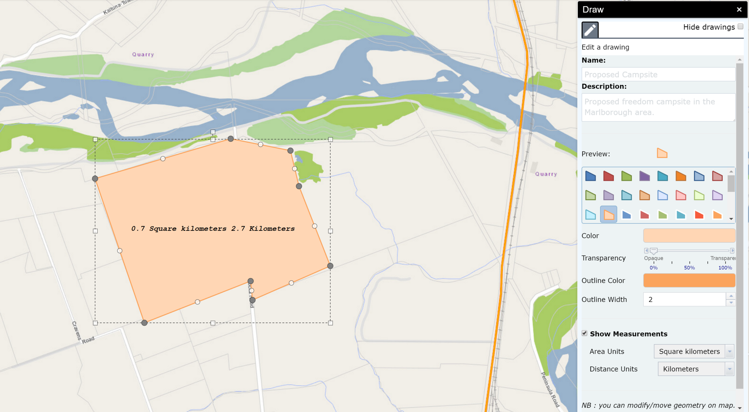
    These tools have been updated to include more options to edit vertices, move, resize, delete and measure drawn shapes. 


    Enhanced Select

    Improvements to the Select tool include adding a buffer radius on the map when a selection is made. We have also addressed various bug fixes (see below).

    Zoom to point 

    Capture co-ordinates using the zoom to point widget rather than using the co-ordinates widget itself.

    Secure Web Maps & Logins

    Based on the user identity you can now surface maps that are not shared publicly. Now when a user logs in to LocalMaps, any maps that they have access to, and have been tagged with LocalMaps, can be displayed directly in their LocalMaps Gallery. This functionality is currently only available in LocalMaps using Portal for ArcGIS (Coming to ArcGIS Online build in August)

    Training and Support

    LocalMaps Administration Training – Designed for administrators, this one-day instructor lead workshop teaches how to successfully manage a LocalMaps install in parallel with your ArcGIS Online subscription account and Enterprise GIS installation. For more info visit –  https://eagle.arlo.co/courses/226-localmaps-administrator-training.

    Coming later this year..

    LocalMaps 2.0 – Built on Web App-builder Version 2.2
    Greater mobile functionality
    Enhanced communication between widgets with new feature actions
    New administration interface
    Improved ability to load and configure new widgets
    More LocalMaps templates – LocalMaps administrators will be able to select from a series of new layouts for the gallery and the viewer

    Get involved!

    Does your organisation have a workflow or idea we should bring into LocalMaps? Get involved and have your say!

    Please send enhancement requests and suggestions to localmaps@eagle.co.nz

  • Eagles Fly around Ruapehu

    Eagles Fly around Ruapehu

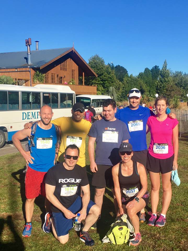
    A group of 10 Eagle staff successfully completed the Ruapehu Express Event last weekend. The event is an adventure style event that involves a 58km Mountain bike and separate 21km and 16km trail runs in the foothills of Mount Ruapehu. As the biggest Mountain Bike event in the North Island, there were over 1000 competitiors who were rewarded with glorious weather and stunning views. As you might expect with a group of GIS professionals, there was a great deal of GPS tracking and analysis follwing the event. Watch this space for some analysis and 3D visualisation.

  • Geodesign – Ancient concept, universal applications, modern tools

    Geodesign – Ancient concept, universal applications, modern tools

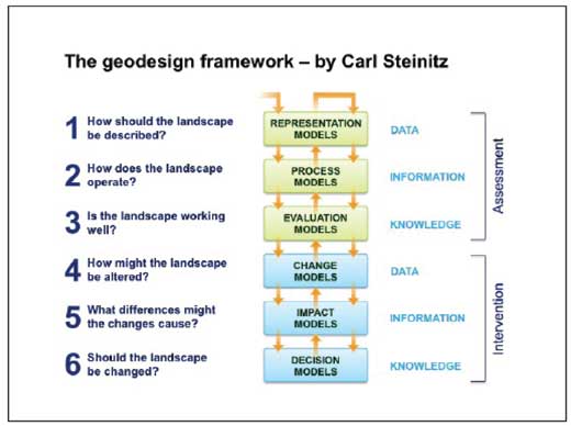
    Geodesign is both a new technology and an old concept. At the inaugural Geodesign Summit held in 2010, contributors variously defined Geodesign as “designing with nature in mind” and “changing geography by design”. At its core is the principal that design should adhere to the natural landscape to lessen environmental impact, achieved through comparing and sharing designs, factoring in the unique attributes of a site and inviting public consultation and collaboration.

  • Geodesign – Academic roots

    Geodesign – Academic roots

    Ian McHarg was the first to describe the concepts behind geodesign in his seminal ‘Design with Nature’ in 1969.

    Ian McHarg was the first to describe the concepts behind geodesign in his seminal ‘Design with Nature’ in 1969. And proponents like landscape architect Jack Dangermond – the guiding force behind Esri, the world’s leading GIS (geographical information system) developer – have been talking about geodesign as a rigorous discipline in academic journals and conferences for years. But, in practice, automating the process has proven to be problematic.