Author: eagle_managewp

  • NZ Esri Young Scholar 2019 announced!

    NZ Esri Young Scholar 2019 announced!

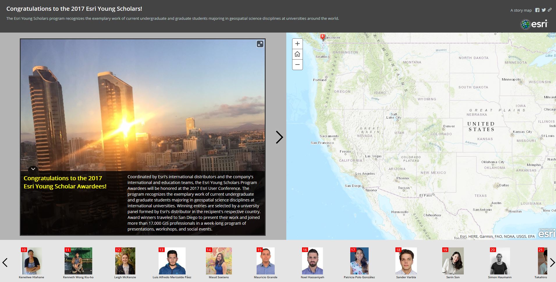
    The Esri Young Scholar Award is about recognising the very best GIS students around the globe. Every year, Esri’s global partners nominate 25 university students for excellence in relation to a GIS project. These projects include comprehensive research papers, software development, impactful maps, and apps that promote education, conservation, disaster response, and urban planning.

    NZ Esri Young Scholar Award 2019 – Winner

    It is with great pleasure that Eagle Technology announces Rose Mwipiko of Massey University as the Winner of the NZ Esri Young Scholar Award 2019.

    To recognise this achievement, Rose will be attending the Esri Education Summit and Esri User Conference in San Diego in July 2019. We look forward to hearing Rose’s reflections on the summit and conference on her return.

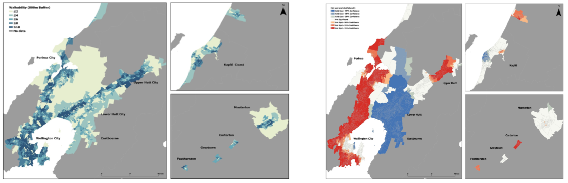
    Rose’s project entitled An exploration of the effects of the Built Environement on Depression in the Wellington Region focused on public health which is an area of geospatial that is slowly developing in New Zealand. Rose explored the relationship of walkability and mental health amongst adolescents in the Wellington Region. Rose’s study demonstrated an association between walkability and symptoms of depression in adolescents and demonstrated that a walkable neighbourhood may help to reduce depressive symptoms. Further research is required to test the walkability model with measures of depressive symptoms in rural and ethnically diverse locations. The findings presented in Rose’s research have implications for clinicians and policymakers. Rose suggests that future research should aim to determine if neighbourhood-level interventions based on characteristics of the built environment might improve health outcomes in adolescents. ArcGIS provided the platform for Rose to undertake her research into this innovative area of geospatial study.

    Thank you to all the other young scholars who applied for the NZ Esri Young Scholar Award in 2019. Your submissions were of the highest standard and made the judge’s job in choosing the best project very difficult.

  • Crisp, New Imagery for Canterbury

    Crisp, New Imagery for Canterbury

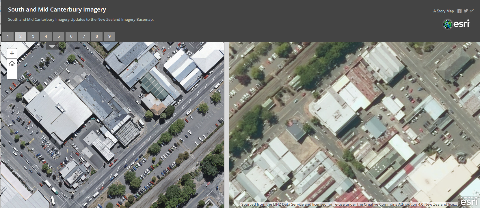
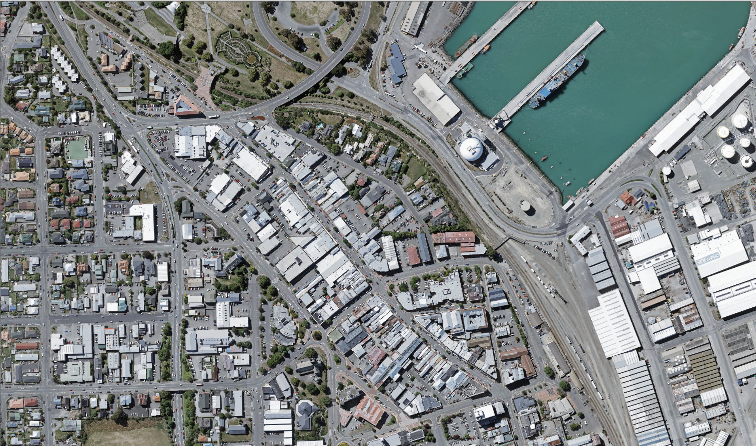
    Earlier this year we updated the NZ Imagery Basemap to add some fantastic detail to both Urban and Rural Mid and South Canterbury. This is part of the ongoing work done by Land Information New Zealand and their collaboration with councils and other public bodies to capture fresh, high resolution imagery and make it available under creative commons licencing.

    The imagery is live in our basemaps already and will be coming to the global Esri Basemap shortly too. However we are so excited to show off the imagery and we have created an ArcGIS StoryMap to highlight these updates which can be viewed here.

    The great thing is that these imagery updates will just continue to roll out and so in the near future we will be incorporating updated imagery for Marlborough, Gisborne and Tauranga. Watch this space for more updates.

  • Bringing school teachers together with GIS

    Bringing school teachers together with GIS

    Eagle Technology and the New Zealand Board of Geography Teachers aim to establish a network of teachers with an expertise in GIS during 2019 and 2020.

    2018 was a big year for Eagle Technology and the New Zealand Board of Geography Teachers (NZBOGT).

    We were contracted by the Ministry of Education to provide teacher-to-teacher support in geography specific professional development during 2019 and 2020.

    The idea behind the contract is to establish an official Ministry of Education sanctioned network of teachers throughout New Zealand that know how to use GIS as part of the New Zealand Geography curriculum in the secondary school classroom. 

    To put that in more education specific language…

    NZBOGT and Eagle Technology aim to:

    • Support all NCEA teachers in their geography pedagogy, curriculum and assessment practices with a focus on equity & excellence;      
    • Distribute leadership at regional levels by providing Professional Learning and Development for, and by, teachers at different stages of their career;      
    • Develop and disseminate resources for teachers with high utility value, that support quality teaching and learning.

    ​Eagle Technology already has a number of resources freely available at https://www.eagle.co.nz/gis-schools to support this aim.

    Twelve GIS champions (teachers who want to diffuse effective Geographic Information Systems teaching and learning in their region) have already been selected to start the Network of Expertise. It is hoped by the middle of 2019 that this number will have increased to 20, two champions for each Ministry of Education region.  To meet the current GIS champions read the New Zealand Board of Geography Teachers Newsletter #3.

    As a GIS Professional there may be a number of opportunities to support schools and teachers who are involved in the GIS Network of Expertise. If offering assistance to teachers is something that you would like to do please contact Eagle Technology at gisinschools@eagle.co.nz

  • NZ Basemaps Update Information

    NZ Basemaps Update Information

    It’s that time of year when everyone’s minds turn to…GIS Basemaps! So, to round out the year we thought we’d give you a quick update on where we are with the super popular Eagle Basemaps.

    Imagery Basemap Improvements

    Firstly, a bit of an update on the latest changes to the awesome NZ Imagery Basemap where we’ve tweaked the settings and imagery to make it even more useful…

    No Image…No More

    Have you ever experienced the dreaded grey tile telling you “No image is available”, when zooming into an Imagery Basemap? Well, with our latest update this issue is no more! We have used a technique called ‘resampling’ which replaces this message with the highest-resolution imagery available for that area. The imagery may not be as crisp in rural areas as it is in urban areas, where higher-resolution imagery is available, but it sure gives better reference than a grey tile!

    Imagery Basemap Before…

    Imagery Basemap now!

    Updated and Improved Imagery

    The Imagery within this Basemap has also had over 20 updates this year including both urban and rural areas with more to come in the first part of next year. These 2019 updates include the following:

    • Mid & South Canterbury Urban/Rural

    • North Canterbury Urban

    • Northland Urban 2015 Imagery (extended content)

    Incoming Mid/South Canterbury Updates:

    Ashburton Domain Old

    Ashburton Domain New

    Stafford Street Timaru (Before)

    Stafford Street Timaru (Now)

    Metadata Rocks!

    Finally, on the Imagery Basemap – we wanted to make sure that you all know about a great way to see e.g. how old the imagery that you are looking at is. We maintain a layer of all of the imagery footprints along with metadata showing the “who, when and how” of the captured imagery. This can be access from the REST service here and easily added to any of your webmaps.

    Other NZ Basemaps

    Outside of the Imagery Basemap we of course keep the other Basemaps up to date including the Canvas & Community ones. These will have a data refresh over the Christmas New year period (no holidays for the servers).

    Vector is the future: Faster, Smaller, Cooler!

    Finally, a bit of an exciting sneak peak at what’s to come in 2019….

    In 2019, coming soon to a map near you are new Eagle Vector Basemaps. Vector Basemaps are lightweight in comparison to their traditional cached counterparts – 10’s of GB compared to 100’s – making them ideal for downloading for offline use, and, require far less time to process, meaning we can provide you with weekly data updates straight from the LINZ Data Service.

    We plan on first rolling out Esri-styled vector Basemaps, however, with tools like the ArcGIS Vector Tile Styler Editor, you can customise their symbology to truly make them your own.

    And, if you’re worried about the support of our current cached Basemaps, don’t be! Our vector Basemaps will be offered as a new alternative, ready to be taken advantage of in ArcGIS Pro and ArcGIS Online. They can even be published as Vector PDFs!

    Below is a quick sneak peek of a new and updated Community vector Basemap!

    Have a great Christmas and New Year and while you’re relaxing on the beach just spare a thought for the poor servers…

    The Eagle Basemap Team

  • GALoP-X 2019: Now Open for Applications

    GALoP-X 2019: Now Open for Applications

    Following the success of this year’s Geospatial Accelerated Learning programme (GALoP), Eagle is excited to announce that we are now taking applications for our new condensed GALoP-X. Starting in February 2019, this is an exciting evolution of the existing GALoP programme designed to condense the key leanings and skills covered in the full GALoP in an intensive 6 week course. The full 3-month GALoP was launched this year in order to help close the skills gap and give participants skills in key technical areas focused on ArcGIS technology combined with understanding how and where GIS fits in to real world scenarios and environments. This includes important areas such as solution architecture, project management, business cases and a greater understanding of the various ways in which geospatial can be applied to problems in the real world.

    GALoP-X is taking applications from both organisations and individuals: employers looking to fast-track their staff into highly productive roles, individuals making the transition from education to a GIS career or indeed experienced individuals making a change from another area to a GIS-focused career.

    Some of the key benefits include the following:

    • Gaining hands-on technical skills to increase productivity and innovation 
    • Building experience with the latest Esri and Esri-related technology
    • Fast-tracking geospatial capability
    • Developing skill sets to undertake a greater variety of work
    • Gaining insights into best practice and how to successfully deliver geospatial projects in-house
    • Equipping attendees with skills to help manage work more effectively and efficiently
    • Gaining a competitive edge with training on the latest technology
    • Investing in either your own or your team’s career development
    • Assisting in the promotion of either your organisation or yourself as an employer / employee to be sought out 
    • Growing your or your organisation’s geospatial network

    Читайте о пуме здесь.

    For more information on the programme - see the 2 page summary or the detailed programme

    The GALOP-X programme commences on February 18th 2019 for 6 weeks at the Eagle offices in central Wellington while the full 3 month GALoP course is scheduled for mid-2019.

    To start GALoPing contact us on galop@eagle.co.nz

  • Relive Some NZEUC 2018 Highlights (from the comfort of your own stand-up desk)

    Relive Some NZEUC 2018 Highlights (from the comfort of your own stand-up desk)

    It has now been a couple of months since the geospatial event of the year – The NZ Esri User Conference – and we know there was a lot to take in at the time. So, we had an idea…

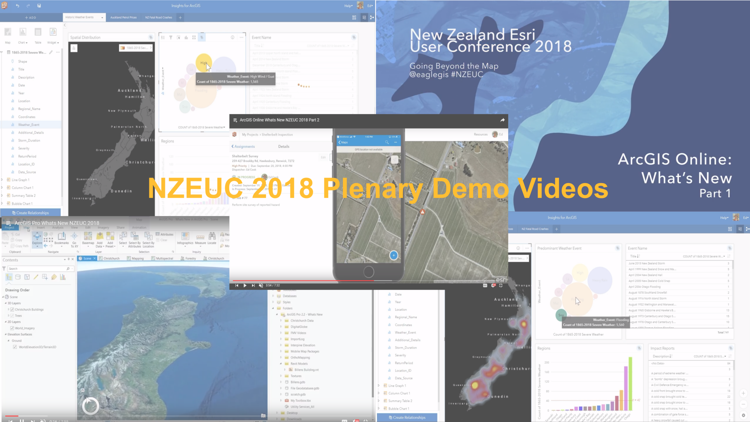
    …in order to refresh your memory about what was shown on the big stage, we thought we’d put up a few videos that cover the main ArcGIS technology demonstrations from the plenary including ArcGIS Online, ArcGIS Hub, ArcGIS Pro and Insights:

    NZEUC 2018 Plenary Video Playlist

    So book out 45 mins from your busy schedule, sit back and enjoy (popcorn optional).

  • What is the ArcGIS Living Atlas and how can I work with it in NZ?

    What is the ArcGIS Living Atlas and how can I work with it in NZ?

    The ArcGIS Living Atlas of the World is a collection of thousands of curated authoritative maps, intelligent map layers, imagery, tools and apps built by ArcGIS users worldwide, by Esri and Eagle and other Distributors across the globe. This rich catalogue of geographic information is available in ArcGIS Online, ArcGIS Enterprise and ArcGIS Pro.

    ArcGIS Online and can be used from around the globe. It includes useful maps, apps, and data layers to support your work and there are multiple ways to explore and use the Living Atlas. Through the ArcGIS Living Atlas app you can browse and preview the layers, maps and apps of the Living Atlas by theme or category. You can also easily search and add Living Atlas layers to you project in ArcGIS Online, ArcGIS Enterprise and ArcGIS Pro.

    New Zealand and the Living Atlas

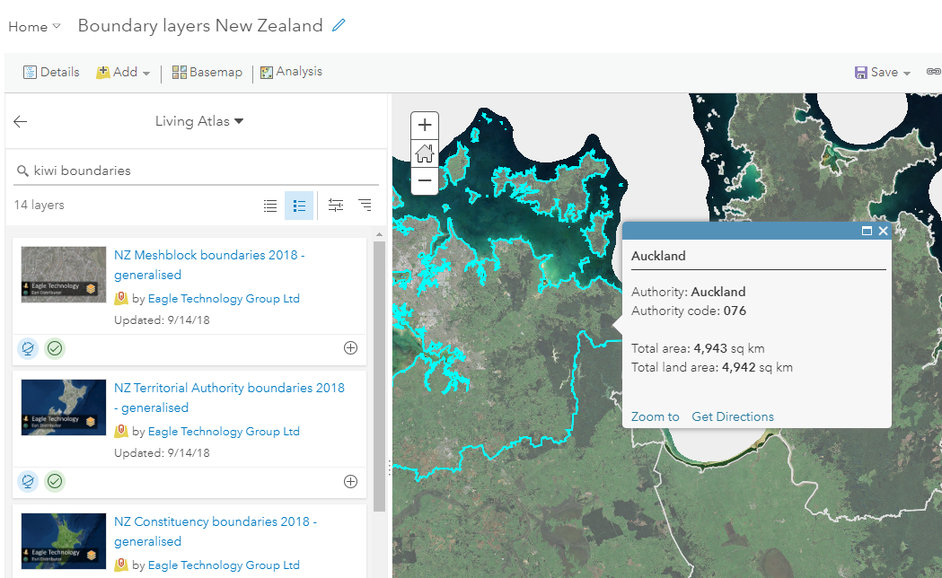
    New in the Living Atlas for New Zealand are boundary layers. Here at Eagle, we have added many authoritative boundary layers to the Living Atlas and these layers can be used throughout the platform. The layers have a default pop-up and symbology, but you can easily change the pop-up and symbology as well as add filters to only show the boundaries that you are interested in.

    What’s better is that you can use these layers in your analyses as well. So, if want to join your data or summarize your data to one of the boundary layers you don’t have to download the layer first. You can just add it to you project in the Map Viewer in ArcGIS Online or in ArcGIS Pro and start your analysis.

    Here is a list of the recently added boundary layers:

    ·         Regional Councils 2018

    ·         Territorial Authorities 2018

    ·         Territorial Authorities Subdivision 2018

    ·         Community Boards 2018

    ·         Urban – Rural Areas

    ·         Mesh Blocks 2018

    ·         Statistical Areas 1

    ·         Statistical Areas 2

    ·         Constituencies 2018

    ·         Maori Constituencies 2018

    ·         Wards 2018

    ·         District Health Boards

    ·         School Enrollment zones

    Where can I find the new layers?

    In the group New Zealand Boundary Layers, you can find all the layers. When you are working on a project you can also easily search for them in the Map Viewer and in ArcGIS Pro and add them to your projects

    ArcGIS Online

    The new layers can be found in ArcGIS Online. They are added to the Living Atlas, so when you search for data, you can select the Living Atlas. Using the filters, you can even filter to only show New Zealand data.

    ArcGIS Pro

    The layers can also be added from ArcGIS Pro. In the Catalog pane, select the Portal tab. Here you can search for data in your own content, your groups and ArcGIS Online. There is also a Living Atlas category where you search for Living Atlas items.

    How can I contribute to the Living Atlas?

     Many of the items in the Living Atlas are contributed by the user community, curated by Esri and the local Esri representative (Eagle in New Zealand and the South Pacific region). The GIS community is known for sharing data and information as we know that we all benefit from it and it allows us to make better informed decisions.

    We would like you to share your authoritative data with the Living Atlas. Making it part of the living atlas will ensure that your data will reach a broad audience and you will help the GIS community making your data available.

    Contributing your data is as easy as 1,2,3:

    1. Just go to the Living Atlas, sign in and click on the tab My Contributions. This app will help to improve your item details and make sure that you have checked all the boxes before nominating it.

    2. After you nominate your item for the Living Atlas, a curator will look at it and if there are any questions, they will get in touch with you.

    3. You will remain the owner of the item, so removing an item or updating an item’s data will be reflected in the Living Atlas.

    If you have any questions about the Living Atlas, contact Boudewijn Boogaard at eagle technology on  bbo@eagle.co.nz.

    Resources

    New Zealand Boundary Layers group

    https://www.arcgis.com/home/group.html?id=8047736c3e43467aa62241976851eff9

    Enable the living Atlas for ArcGIS Enterprise

    http://enterprise.arcgis.com/en/portal/latest/administer/windows/configure-living-atlas-content.htm

    Living Atlas

    https://livingatlas.arcgis.com
  • NZ Esri Young Scholar 2018 announced!

    NZ Esri Young Scholar 2018 announced!

    The Esri Young Scholar Award is about recognising the very best GIS students around the globe. Every year, Esri’s global partners nominate 25 university students for excellence in relation to a GIS project. These projects include comprehensive research papers, software development, impactful maps, and apps that promote education, conservation, disaster response, and urban planning.

    NZ Esri Young Scholar Award 2018 – Winner

    This year Eagle Technology had the honour of reviewing some really outstanding work from NZ students at universities across the country.

    This process resulted in a fantastic winner. It is with pleasure that Eagle Technology announces Daniel Surkalim of The University of Auckland as the Winner of the NZ Esri Young Scholar Award 2018.

    To recognise this achievement, Daniel will be attending the Esri Education Summit and Esri User Conference in San Diego in July 2018. We look forward to hearing Daniel’s reflections on the summit and conference on his return.

    Daniel’s project entitled Vehicles of Health Inequities focused on population health which is an area of geospatial that is slowly developing in New Zealand. Daniel explored the relationship between life expectancy and living near major Auckland public transport hubs. While Daniel’s study found that there was no relationship between these two items, he was able to discover several new lines of enquiry that will be able to be explored further in the future which will be able to inform future planning and decision making in a spatial context in Auckland as it becomes a “smarter” city. ArcGIS provided the platform for Daniel to undertake his research into this innovative area of geospatial study.

    Eagle Technology would also like to acknowledge Daniel Exeter, Daniel Surkalim’s lecturer and supervisor, for his tireless work enabling population health research through the use of geospatial technology in New Zealand and empowering Daniel to complete his study.

    Thank you to all the other young scholars who applied for the NZ Esri Young Scholar Award in 2018. Your submissions were of the highest standard and made the judge’s job in choosing the best project very difficult.

  • 2018 Training goals

    2018 Training goals

    Claire Thurlow – GIS Training and Education Manager

    Did you make a work New Year’s resolution for 2018? Maybe it was to further upskill across the ArcGIS Platform, if it was perhaps you would like to explore the five courses listed below.

    1 Python for Everyone (3 hrs, 30 min FREE web course) – Learn fundamental Python concepts and be introduced to the Python scripting environment in ArcGIS. Tips and techniques to help you master proper Python syntax, script flow, and error handling are presented.

    2 Get Started with Insights for ArcGIS (1 day instructor led) – Get prepared to work with Insights for ArcGIS to dynamically visualise and analyse data from multiple sources on maps, charts, tables, and more. This course specifically focused on user workflows. Contact gistraining@eagle.co.nz if you would like to explore how to administrator Insights for ArcGIS from the back end.

    3. Do it Yourself GeoApps (Sept 6 – Oct 4, 2018 FREE MOOC) – Learn how to combine location and narrative in one application to better communicate and broadcast your story, create custom web applications that solve problems in your community, and build powerful native applications for iOS and Android devices without touching a piece of code.

    4. Migrating from ArcMap to ArcGIS Pro (2 day instructor led) – Streamline your ArcGIS projects with the new ArcGIS Desktop app, ArcGIS Pro by learning essential ArcGIS Pro terminology and concepts and how to efficiently complete a variety of tasks related to mapping, editing, analysing, and sharing geospatial data and resources.

    5. ArcGIS Enterprise: Configuring a Base Deployment (2 days instructor led) – Learn how to install and configure an ArcGIS Enterprise base deployment to enable individuals to securely access, create, and share geospatial resources to boost collaboration and gain location-based insights.

    If none of these courses tickle your fancy, check out the ArcGIS Learning Pathways at http://arcg.is/2wBrRPk

  • Auckland – Teachers upskill in ArcGIS

    Auckland – Teachers upskill in ArcGIS

    Claire Thurlow – GIS Training and Education Manager

    In early December, Zorko Sostaric and I, travelled to Botany Downs Secondary School in Auckland to enable a group of Auckland based teachers to use GIS in their classroom in 2018.  ArcGIS Online and several of the apps that are included with an ArcGIS Online subscription were covered. There were five schools represented in the room and in most cases there were multiple teachers from a school attending.

    We had a mix of abilities in the classroom. Some of the teachers had used ArcMap in the past so wanted to translate their skills to ArcGIS Online. Some of the teachers had learnt the basics of ArcGIS Online and wanted to know more. While others were total newbies to ArcGIS Online having managed to activate their schools ArcGIS Online account but not much more. We therefore, started out simple and all the teachers created some map notes on a web map reflecting the tasks set out in the ArcGIS Online basics – Editing school lesson. We then ran through how to locate and add layers of information from ArcGIS Online into a web map and then let people loose to have an explore for data they thought they could use for lessons in the classroom. This data ranged from spatial information about the Great Pacific garbage patch, to Census data for New Zealand, to the most recent earthquakes in New Zealand and the world.

    We also had a look at the Geoinquiries localised to the New Zealand school curriculum that are available at the bottom of the http://www.eagle.co.nz/gis-schools page.

    Just before lunch, we broke out Survey123 for ArcGIS and created a simple survey that enabled us to collect the location and some basic information about benches around the school. We then quartered the school, split into groups and escaped the classroom with our devices to capture some ‘real’ data. After about a 20 minute field trip we returned to the classroom to view our data in a web map and to have an interesting discussion about the quality and precision of the data captured. In the end it all came back to the age old question of how good is good enough for data accuracy?

    Once back from a late lunch we took a stroll through Story Maps (both worldwide and local) and discussed how they could be used in the classroom by teachers and / or students.

    As our final task of the day we plunged into the NCEA level 1, 2 and 3 resources available on the GIS in Schools website

    NCEA Level 1
    NCEA Level 2
    NCEA Level 3

    A big thank you to Sally Brodie for organising this event and Botany Downs Secondary College for hosting us in December.

    #NZGISinSchools