Author: eagle_managewp

  • NZ Vector Basemap February Update: 3 New Styles Released!

    NZ Vector Basemap February Update: 3 New Styles Released!

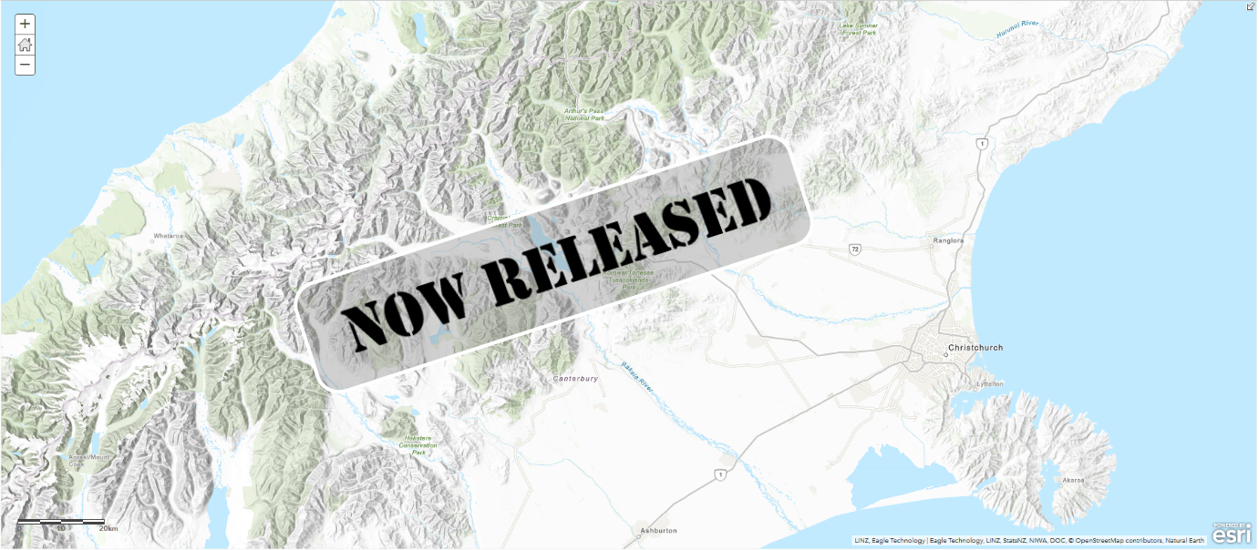
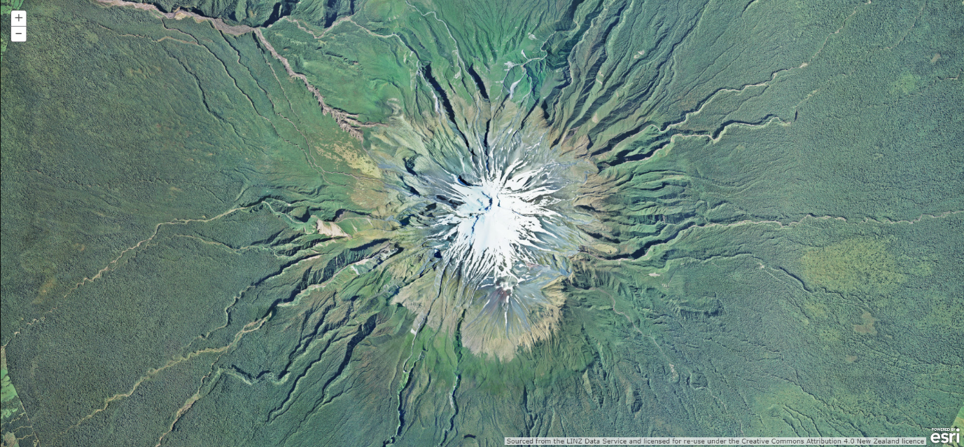
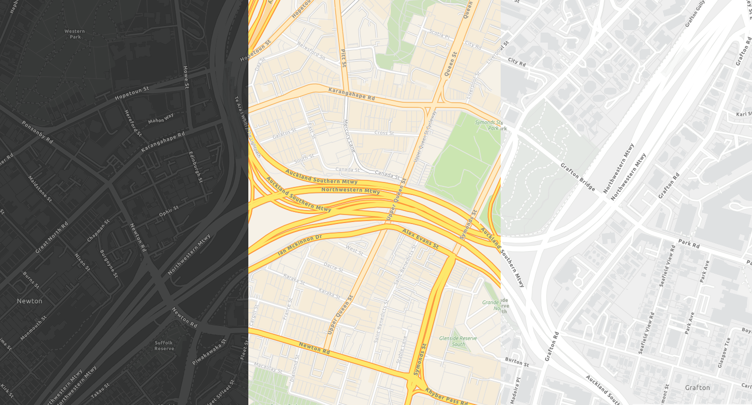
    At the end of 2019, we released our first New Zealand vector basemap, our NZ Topographic Map and today we are pleased to announce the release of 3 new styles…

    These new styles are as follows:

    These styles are all based on Esri’s World Basemap styles and allow you to customise the style of the basemap to your heart’s content using Esri’s Vector Tile Style Editor.

    What sets these NZ basemaps apart from Esri’s world basemaps is that:

    • They are delivered in New Zealand’s Transverse Mercator (NZTM) Projection, and
    • They bring together the most up to date freely available datasets in New Zealand

    If you’d like to get hands on immediately with the new styles, check out our latest StoryMap update. Or, if you missed our first release at the end of last year and you’d like to find out more information on the benefits of vector basemaps, please visit our original StoryMap.

    Start using the new basemaps today!

    By default, your organization uses a basemap gallery set by Esri. You can configure your basemap gallery if you have administrator privileges in your organization. For example, you can combine Esri’s Web Mercator basemaps with Eagle’s NZTM basemaps, or you can create a completely custom basemap gallery including basemaps authored by you. This could include your own stylised version of the vector tiles. To find out more on how to add custom basemaps to your organisations basemap group, click here.

    If you’d like to add the new vector basemaps to your ArcGIS Online or Portal organisation, or to keep up to date with the latest styles to be released, please join the Eagle Technology NZ Vector Basemap group and save them to your organisation.

    And of course, you can find the new basemaps by searching the Living Atlas within the ArcGIS Online map viewer or within ArcGIS Pro.

    What’s coming…

    5 styles down, many more to come!

    • Tiling Scheme changes for our existing raster basemaps so you can overlay NZ Imagery with our new vector basemaps.
    • More NZ styles: Canvas Reference, Canvas BaseImagery HybridCommunity and more.
    • Regular, automated data updates from LINZ, OpenStreetMap and more.
    • More ready to use content made available in the Living Atlas.

    Feedback

    The existing Eagle basemaps are incredibly popular and we think our new vector basemaps will be even more so! We encourage you to start using them by adding them to your basemap gallery and we are excited to see how you style your own basemaps. So get creative, build your own styles, and we’d love it if you were to share them with us.

    We really value your feedback, so if you have any comments, queries or suggestions on the vector basemaps, please let us know at livingatlas@eagle.co.nz.
  • Esri ArcGIS used to track Coronavirus

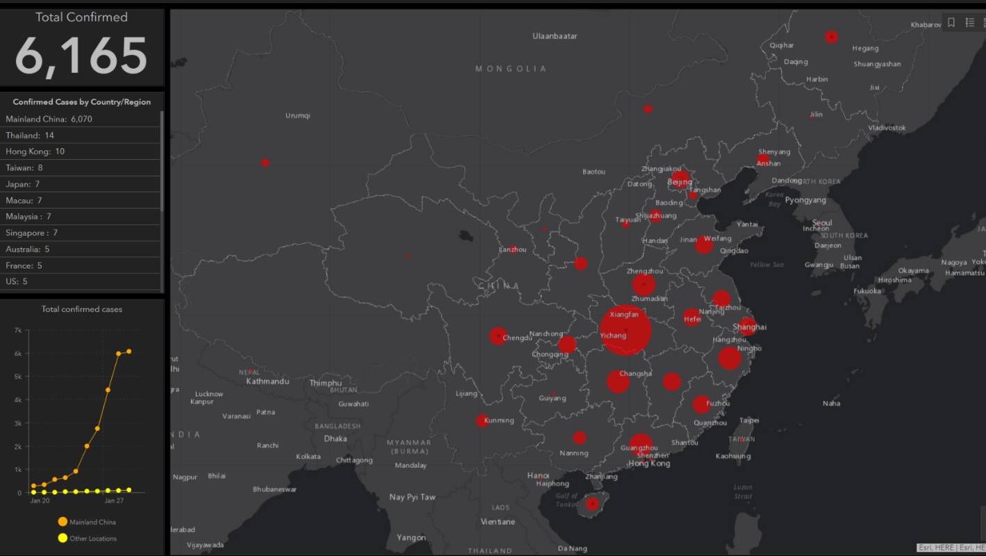
    Esri ArcGIS used to track Coronavirus

    Coronavirus outbreak: Map tracks Wuhan coronavirus spread https://t.co/RNRm4wjPE2 pic.twitter.com/6SPFdueHMK

    — Stuff (@NZStuff) January 30, 2020

  • GALoP-X 2020 Summer Open for Students

    GALoP-X 2020 Summer Open for Students

    New Zealand’s Geospatial Accelerated Learning Programme Express is Open.

    Eagle Technology taking applications for the GALoP-X 2020 Summer.

    Starting on the 17 Feburary 2019, this is the 5th intake for the Geospatial Accelerated Learning Programme (GALoP) programme with the express 6 week version designed to condense the key leanings and skills needed to either kick start or re-invigorate a GIS career. Alongside the hands-on technical skills, the course provides overviews of key areas such as solution architecture, project management, business cases as well as a greater understanding of the various ways in which geospatial can be applied to problems in the real world.

    GALoP-X is taking applications from both organisations and individuals:

    • employers looking to fast-track their staff into highly productive roles,

    • individuals making the transition from education to a GIS career; or 

    • experienced individuals making a change from another area to a GIS-focused career.

    Some of the key benefits include:

    • Gaining hands-on technical skills to increase productivity and innovation 

    • Building experience with the latest Esri and Esri-related technology

    • Fast-tracking geospatial capability

    • Developing skill sets to undertake a greater variety of work

    • Gaining insights into best practice and how to successfully deliver geospatial projects in-house

    • Equipping attendees with skills to help manage work more effectively and efficiently

    • Gaining a competitive edge with training on the latest technology

    • Investing in either your own or your team’s career development

    • Assisting in the promotion of either your organisation or yourself as an employer / employee to be sought out 

    • Growing your or your organisation’s geospatial network

    For more information on the programme – see the detailed programme.

    The GALOP-X 2020 Summer programme commences on 17 February 2020 for 6 weeks at the Eagle offices in central Wellington.

    To start GALoPing contact us on galop@eagle.co.nz

  • The Next Generation of NZ Basemaps are Here: Vector Basemaps in NZTM!

    The Next Generation of NZ Basemaps are Here: Vector Basemaps in NZTM!

    Following two beta versions earlier this year, we are now very excited to announce that the full version of the new NZ Topographic Basemap is now released.

    This is the first of our next generation of Basemaps: Vector Basemapswhich are cached and delivered as vector tiles and are rendered client-side based on a style file that is delivered with the vector tiles. Like all of our existing NZ Basemaps which it complements, the new Basemap is delivered in the NZTM projection and will align with your NZ data.

    You can find the new Basemap layer and the associated WebMaps along with versions which include hill-shading in this group (we recommend joining this group as we will be adding all of the new vector styles to this group also) as well as this nice StoryMap.

    The NZ Topographic Map’s style is based on the World Topographic map from Esri and is a great way to enhance your existing and new maps. Early in the new year, we will also be releasing more styles as vector Basemaps like the Canvas maps, Navigation map and a hybrid style that can be overlaid with the NZ Imagery Basemap.

    New to Vector Basemaps? Check out some background information below…

    Why use Vector Basemaps?

    Vector Basemaps have some significant benefits over raster Basemaps:

    Crisp – Because vectors are delivered to the client, the Basemaps always look crisp, also on high resolution devices and down to the lowest zoom level.

    Labels – More and more apps allow for map rotation. With vector Basemaps, your labels will rotate with the map, making them easy to read regardless of the bearing of your map.

    Size – Vector Basemaps are a fraction of the file size of raster Basemaps. This makes it easier to take the maps offline. Taking the whole of New Zealand offline is now easily possible. To support this, we will start sharing the vector tile packages that can be used to be side loaded onto your mobile device or to be used in Mobile Map Packages where you can combine the Basemap with your own data and take everything offline.

    Style – A great benefit of vector tiles is that they give you the ability to style the Basemap to meet your cartographic needs. This can include turning layers off that you do not require, changing the symbology of features, change the font and appearance of labels or changing the visibility range of select layers. Once you are satisfied with your changes, you can save the edited style to use as a Basemap in your maps and apps.

    NB To make it easier to change the style of a vector Basemap, Esri has released the Vector Style Editor that gives you a nice user interface to change the style of any vector Basemap. You can access the Vector Style Editor from the ArcGIS Online Map Viewer or you can start it from here. See this blog post on the Vector Style Editor for more information.

    How to use Vector Basemaps in your Organization?

    By default, your organization uses a Basemap gallery set by Esri. You can configure your Basemap gallery if you have administrator privileges in your organization. For example, you can combine raster and vector Basemaps, Web Mercator and NZTM Basemaps or you can create a completely custom Basemap gallery with custom Basemaps (e.g. authored by you), Eagle Basemaps and Esri’s Basemaps. A good blog about how to configure the Basemap gallery for your organization can be found here.

    The existing Eagle Basemaps are incredibly popular and we think our new Vector Basemaps will be even more popular so go make some awesome WebMaps and as always we really value your feedback at livingatlas@eagle.co.nz.

    References

  • WE’RE ADDING MORE ZOOM LEVELS TO THE NEW ZEALAND BASEMAPS (AND MAKING SOME CHANGES)

    WE’RE ADDING MORE ZOOM LEVELS TO THE NEW ZEALAND BASEMAPS (AND MAKING SOME CHANGES)

    Please Note that this change has been postponed until later this year, please watch this space for more updates. The New Basemap Schema described below is availabe in the meantime on the following URL for testing purposes:

    https://services1.arcgisonline.co.nz/arcgis/rest/services/


    Beneath every engaging WebMap, lies an unsung hero: a Basemap providing a background of geographic context for all of the content in your maps…

    Eagle Technology offers a range of Basemaps in the New Zealand Transverse Mercator (NZTM) Projection that you can choose from when you create a new map. These Basemaps are used by hundreds of organisations across NZ, with the most popular of the bunch being the New Zealand Imagery Basemap, one which is updated regularly with the latest publicly-owned aerial imagery. Over the years, we have seen the usage of our Basemaps grow, and in those years, the requirements of our users have changed. That is why we’ll be making some changes to our existing Basemaps.

    As part of its definition, every Basemap has rules to say how far you can zoom in and out in most of the apps and over the years we have received requests to allow for more zoom levels to support different use cases.  A couple of years ago we have added more zoom levels to our imagery Basemap, which now zooms in to 1:282. 

    At 4pm this Wednesday 18/12/19 we will be expanding the zoom levels even further for all our Basemaps. We will add levels to the smaller scales (to allow you zoom further out beyond NZ coastlines) and more importantly add new zoom levels to the larger scales (for zooming right in). The smallest scale will be 1: 591,657,527 and the largest scale will be 1:70. For the new larger scale zoom levels we will be using a technique called resampling, that means you’re basically zooming into the image of a smaller scale. This means that for those levels, the map will not look as crisp, but it does allow you to zoom in when you need to (such as to look at detailed feature layers which lie on top of the Basemap).

    For almost all the maps and apps this will be a smooth transition. After you reopen ArcGIS Pro or ArcMap or refresh the web page, you’ll be able to make use of the new zoom levels. There are a few to things to be aware of:

    • In ArcMap you may need to refresh your local display cache if you don’t see the Basemap showing up. Here you can read how to do that.
    • If you have your own cached maps, that uses the same zoom levels as one of our Basemaps and you have overlaid that map with one of our Basemaps current zoom levels they will still work in almost all the apps except for 3D web scenes. If you want to overlay you own maps with our Basemaps in the 3D scene viewer please re-cache your maps using the new tiling scheme, that can be found here
    • If you have a web application which explicitly requests a specific tile level e.g. tile level 0 then this may now result in a you initially viewing a different extent (i.e. zoomed out much further). This can be addressed by changing the requested zoom level to be 5 levels higher than previously e.g. zoom level 1 becomes zoom level 6. NB for a finite period of 3 months, we will have the old basemaps available on a different URL. Please contact gissupport@eagle.co.nz for more information.

    Please note that separate to the zoom level changes, we have found that some users still use a very old URL to access our Basemaps. In order to ensure a high quality ongoing delivery of our Basemap services, and to aid with the transition, we will be turning that URL off. If you still use that URL, please switch to the official URL as per below:

    As stated, we don’t expect any down time apart of these changes, but some minor disruptions may occur. If you have any questions about the upcoming change, please get in touch with us on livingatlas@eagle.co.nz.

    References

  • What’s New in LocalMaps 2.3

    What’s New in LocalMaps 2.3

    LocalMaps 2.3 was released this month! 

    This is our sixth release since the solution’s inception in 2015 and with it has come some great new features for users.

    Scroll down to see some of the key updates in this version…

    NEW Conditional Reporting

    • Admins can now combine a series reports into one “Conditional Report”. When the user runs this, depending on what layers their property intersects with only the applicable reports will be pulled into the output. 

    • e.g. Hazards Reporting: If a Property intersects with a flood layer, include a detailed report with text/map/image elements about the risk. If a parcel does not intersect, do not include the element but include other reports.

    Reporting Enhancements

    • Generate reports as a Word document

    • Generate reports based on a buffered area

    • Include Inline maps

    • Include XY’s

    • New rich text editor for text elements

    • New table element editor to provide more flexibility of table appearance

    • New conditional text element

    • New report button to generate reports within viewer pop-ups

    Draw / Measure Enhancements: Users can now export drawings as GPX and KMZ

    Search Enhancements: Users can tick on or off what searches to use from the drop-down. They can also preview a search result by hovering over the suggested result to zoom to the location before. These can be disabled by administrators if needed.

    Feature Queries: You can now build feature queries off a hosted feature tables.

    Want to get onto Version 2.3? Contact your Eagle Account Manager for more information. 

    If you have any comments, questions or suggestions please feel free to contactlocalmapssupport@eagle.co.nz.

    Ngā manaakitanga,

    The LocalMaps Team 

  • Eagle Flyer

    Eagle Flyer

    The latest Eagle Flyer, October 2019 is available to view here

  • NZ Spatial Excellence Awards 2019

    NZ Spatial Excellence Awards 2019

    It was fantastic catching up with so many of you last week at the New Zealand Spatial Excellence Awards and great to see how well the industry is doing.

    It is also vital to acknowledge the individuals and organisations making such valuable contributions to our industry – here at Eagle we’re especially proud of those within our team involved with or receiving awards.

    Claire Thurlow was announced as the winner of the Educational Development Award for her amazing efforts with the GIS in Schools programme. A demonstration of this programme’s success is the fact that as of last week, there are now 250 schools using ArcGIS Online to teach GIS in the classroom – well done Claire! 

    Another one of the team who was part of the winner’s circle is Ed Cook – a member of the NZGIS4EM Committee which was represented on the night by Ed along with Susan Shaw from LINZ, Kate Waterhouse from BoPRC and Craig McAlpine from FENZ. The NZGIS4EM is a group made up of individuals from well over one hundred different organisations from across NZ, all using GIS to better prepare for, and respond to emergencies. The group received the People and Community organisational category award for their vital role in responding to events such as the Pigeon Valley Fire, and to top it off they were also declared as the winners of the Supreme Award for 2019 – an outstanding achievement for the NZGIS4EM team.

    Congratulations to all the winners and nominees for 2019 – keep up the awesome work!

  • Have you heard about the Eagle GIS Webinars?

    Have you heard about the Eagle GIS Webinars?

    To complement our catalogue of training materials and courses, Eagle Technology recently launched a new series of webinars to offer insight into the latest additions and updates to the Esri ArcGIS Platform.  

    These 30 to 60 minute webinars are hosted online via GoToWebinar and cover focussed specialist topics such as ArcGIS Urban or How GIS used used with Gaming Engines, as well as latest updates to the core products such as ArcGIS Pro and ArcGIS Online. You can look forward to concise overviews, real-world software demonstrations, and tips and tricks discovered by Eagle’s webinar hosts, along with the opportunity to hear questions from your colleagues and ask questions of your own.  

    These webinars are FREE for anyone to join, so all you have to do is register online, sit back with a coffee and learn! 

    If you can’t tune in for a webinar at the given time, then simply register your interest for another date or view previous recordings on our website. So far, we’ve hosted webinars covering “What’s new in ArcGIS Pro” and “ArcGIS Urban” with awesome feedback but don’t worry if you misssed then as you can find these recordings on the website too Ilinked in the previous pages).

    Check out the list of upcoming Webinars and make sure you keep up with the ArcGIS latest technology.

    Upcoming Webinars Listing

    Also, if there are other topics you’d like to hear more about then please let us know by email: gistraining@eagle.co.nz.

    We hope to see you online soon!

  • Eagle is Looking for Highly Experienced GIS Consultants

    Eagle is Looking for Highly Experienced GIS Consultants

    Eagle is the Esri Official Distributor for New Zealand and this year we celebrate 50 years of being in business and as well as having been a close partner of Esri for many decades. Our company is highly successful and we need skilled GIS consultants to.join our growing team.

    Our team do all kinds of GIS work: mainly ArcGIS Enterprise implementations, Enterprise upgrades, ArcGIS configuration or custom coding and integrations with other systems such as ERP Systems, document management systems or transportation systems etc. Due to the fact that Eagle is the Esri Official Distributor we serve a huge variety of different types of clients, which keeps things interesting; everything from government and city/local government agencies, defence, emergency services, utility organisations, environmental protection organisations, Maori organisations right through to non-profit organisations.

    What qualities are we looking for with these roles:

    • Ideally, we want all-rounders (‘full stack’ people). ArcGIS people that also know about general IT, databases, security, scripting, complimentary and competing software options and that understand at least the basic concepts of coding.
    • You must have good knowledge of large sections of the ArcGIS platform. While we recognise that ArcGIS is very broad in its scope and typically individuals focus on key areas, you will need to have sufficient knowledge of a useful subset. In our experience, candidates who have worked recently for other Esri distributors or business partners in a consulting role are often a good fit for the skills needed within our team.
    • You should speak and write English as well as a native English speaker. These roles will involve talking to our clients and writing documentation and emails, for which we need to have near-perfect English all the time and rapidly. If you don’t speak or write business level English extremely well then your application will not proceed.
    • You should have good ‘soft skills’ such as good communication skills with clients and other team members.
    • If applying from overseas then you must qualify through NZ immigration rules. For many countries this is a relatively straight-forward process and for the right candidates Eagle can assist you with this. However if you have a criminal record or any other background that would concern our immigration agencies then we will not hire you.
    • We have of course looked for many months within our own country in the first instance to seek people with the above skills, and we have hired many kiwis prior to considering looking for overseas applicants, and we still welcome any suitable applicants from New Zealand and they will have precedence over overseas applicants, however the skills mentioned in the top two bullet points above in particular are in short supply (I think they are around the world actually if you are looking to enhance your skills!)

    One of the highlights of the year working at Eagle is when we organise and host the NZ Esri User Conference. This conference attracts 600+ attendees, and as well as the informative talks from Esri, Eagle and people using our software we also let our hair down with an awesome costume party!

    Note: Unlike most GIS teams in NZ, we have a focus on enabling others to be successful using GIS technology and we are not looking for traditional ‘GIS Analysts’ i.e. those mostly familiar with making maps or doing the actual analysis using ArcGIS software. Rather we are seeking individuals who understand ArcGIS for Server, Portal for ArcGIS, Datastore etc and who are able to design, build and configure the systems for our customers to use.

    For more information about the roles we are currently looking to fill as well as how to apply, please see the below:

    3 x Auckland full time GIS consultants

    Auckland or Wellington GIS consultant with Utility focus

    Full time technical advisor (Auckland)